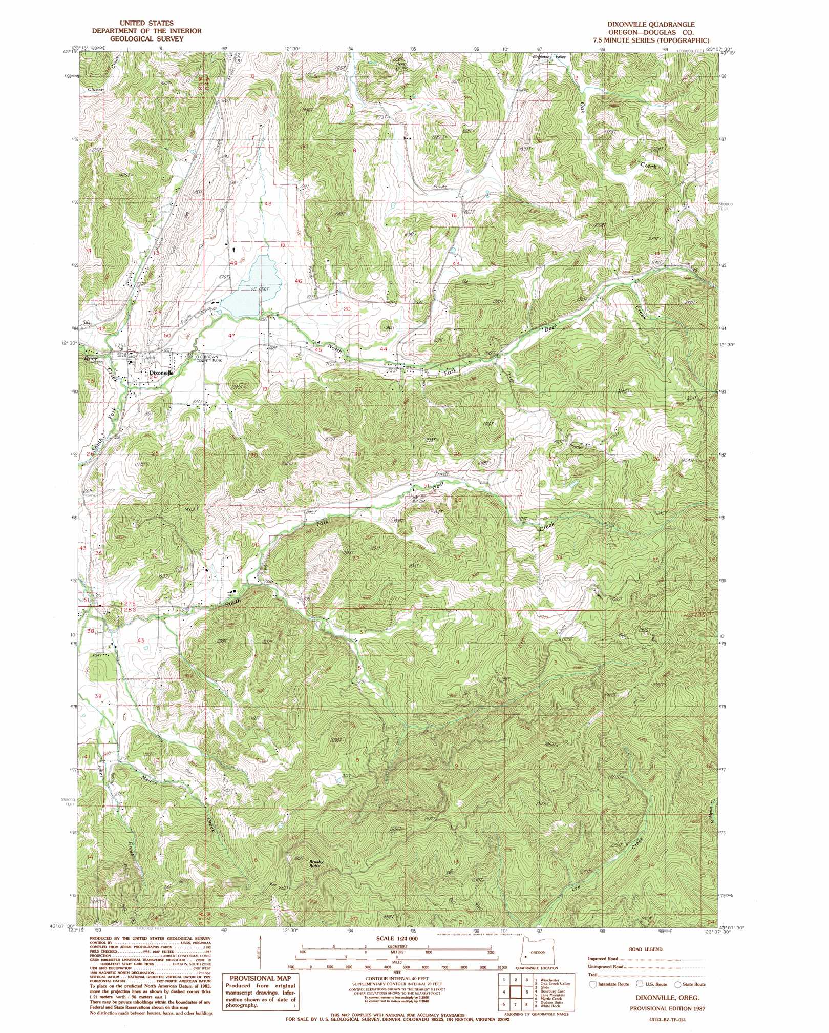
Dixonville Topo Map Oregon
To zoom in, hover over the map of Dixonville
USGS Topo Quad 43123b2 - 1:24,000 scale
| Topo Map Name: | Dixonville |
| USGS Topo Quad ID: | 43123b2 |
| Print Size: | ca. 21 1/4" wide x 27" high |
| Southeast Coordinates: | 43.125° N latitude / 123.125° W longitude |
| Map Center Coordinates: | 43.1875° N latitude / 123.1875° W longitude |
| U.S. State: | OR |
| Filename: | o43123b2.jpg |
| Download Map JPG Image: | Dixonville topo map 1:24,000 scale |
| Map Type: | Topographic |
| Topo Series: | 7.5´ |
| Map Scale: | 1:24,000 |
| Source of Map Images: | United States Geological Survey (USGS) |
| Alternate Map Versions: |
Dixonville OR 1987, updated 1987 Download PDF Buy paper map Dixonville OR 2011 Download PDF Buy paper map Dixonville OR 2014 Download PDF Buy paper map |
1:24,000 Topo Quads surrounding Dixonville
Tyee Mountain |
Sutherlin |
Nonpareil |
Hinkle Creek |
Harrington Creek |
Garden Valley |
Winchester |
Oak Creek Valley |
Glide |
Old Fairview |
Roseburg West |
Roseburg East |
Dixonville |
Lane Mountain |
Red Butte |
Winston |
Myrtle Creek |
Dodson Butte |
White Rock |
Deadman Mountain |
Nickel Mountain |
Canyonville |
Days Creek |
Milo |
Tiller |
> Back to 43123a1 at 1:100,000 scale
> Back to 43122a1 at 1:250,000 scale
> Back to U.S. Topo Maps home
Dixonville topo map: Gazetteer
Dixonville: Bridges
Krogel Bridge elevation 179m 587′Dixonville: Dams
Dixonville Log Pond Dam elevation 200m 656′Dixonville: Parks
O C Brown County Park elevation 185m 606′Dixonville: Populated Places
Dixonville elevation 184m 603′Dixonville: Post Offices
Dixonville Post Office (historical) elevation 184m 603′Lurley Post Office (historical) elevation 365m 1197′
Dixonville: Reservoirs
Dixonville Log Pond elevation 200m 656′Johnston Log Pond elevation 591m 1938′
Dixonville: Streams
East Fork High Prairie Creek elevation 409m 1341′High Prairie Creek elevation 395m 1295′
Livingston Creek elevation 199m 652′
Melton Creek elevation 229m 751′
Middle Fork of South Fork Deer Creek elevation 235m 770′
North Fork Deer Creek elevation 173m 567′
Rose Creek elevation 322m 1056′
South Fork Deer Creek elevation 173m 567′
Tucker Creek elevation 194m 636′
West Fork High Prairie Creek elevation 409m 1341′
Dixonville: Summits
Black Mud Summit elevation 290m 951′Brushy Butte elevation 919m 3015′
Dixonville digital topo map on disk
Buy this Dixonville topo map showing relief, roads, GPS coordinates and other geographical features, as a high-resolution digital map file on DVD: