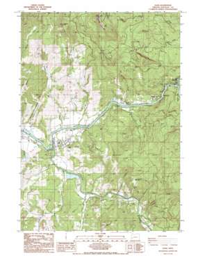
Glide Topo Map Oregon
To zoom in, hover over the map of Glide
USGS Topo Quad 43123c1 - 1:24,000 scale
| Topo Map Name: | Glide |
| USGS Topo Quad ID: | 43123c1 |
| Print Size: | ca. 21 1/4" wide x 27" high |
| Southeast Coordinates: | 43.25° N latitude / 123° W longitude |
| Map Center Coordinates: | 43.3125° N latitude / 123.0625° W longitude |
| U.S. State: | OR |
| Filename: | o43123c1.jpg |
| Download Map JPG Image: | Glide topo map 1:24,000 scale |
| Map Type: | Topographic |
| Topo Series: | 7.5´ |
| Map Scale: | 1:24,000 |
| Source of Map Images: | United States Geological Survey (USGS) |
| Alternate Map Versions: |
Glide OR 1987, updated 1987 Download PDF Buy paper map Glide OR 1987, updated 2000 Download PDF Buy paper map Glide OR 2011 Download PDF Buy paper map Glide OR 2014 Download PDF Buy paper map |
| FStopo: | US Forest Service topo Glide is available: Download FStopo PDF Download FStopo TIF |
1:24,000 Topo Quads surrounding Glide
> Back to 43123a1 at 1:100,000 scale
> Back to 43122a1 at 1:250,000 scale
> Back to U.S. Topo Maps home
Glide topo map: Gazetteer
Glide: Bridges
Floyd Frear Bridge elevation 201m 659′Glide Bridge elevation 205m 672′
Lone Rock Bridge elevation 208m 682′
Glide: Dams
Little River Log Dam elevation 222m 728′Updegrave Dam elevation 235m 770′
Glide: Gaps
The Narrows elevation 230m 754′Glide: Parks
Colliding Rivers Park elevation 208m 682′Lone Rock Wayside County Park elevation 240m 787′
Glide: Pillars
Buck Rock elevation 744m 2440′Glide: Populated Places
Glide elevation 210m 688′Hoaglin (historical) elevation 268m 879′
Idleyld Park elevation 236m 774′
Peel elevation 254m 833′
Rockland (historical) elevation 255m 836′
Glide: Post Offices
Glide Post Office elevation 210m 688′Hoaglin Post Office (historical) elevation 268m 879′
Idleyld Park Post Office elevation 236m 774′
Pattersons Mills Post Office (historical) elevation 233m 764′
Peel Post Office (historical) elevation 254m 833′
Tioga Post Office (historical) elevation 239m 784′
Glide: Reservoirs
Little River Log Pond elevation 222m 728′Updegrave Reservoir elevation 235m 770′
Glide: Streams
Bradley Creek elevation 209m 685′Britt Creek elevation 219m 718′
Buckhorn Creek elevation 217m 711′
Engels Creek elevation 256m 839′
Fall Creek elevation 233m 764′
French Creek elevation 209m 685′
King Creek elevation 233m 764′
Little River elevation 206m 675′
Old Hatchery Creek elevation 229m 751′
Rattlesnake Creek elevation 259m 849′
Rock Creek elevation 241m 790′
West Fork Britt Creek elevation 241m 790′
Williams Creek elevation 246m 807′
Glide: Summits
Ace Williams Mountain elevation 545m 1788′Copeland Butte elevation 769m 2522′
Hog Mountain elevation 534m 1751′
Scott Mountain elevation 1259m 4130′
Watson Mountain elevation 700m 2296′
Glide: Valleys
Hughes Canyon elevation 214m 702′Glide digital topo map on disk
Buy this Glide topo map showing relief, roads, GPS coordinates and other geographical features, as a high-resolution digital map file on DVD:


