Winchester Topo Map Oregon
To zoom in, hover over the map of Winchester
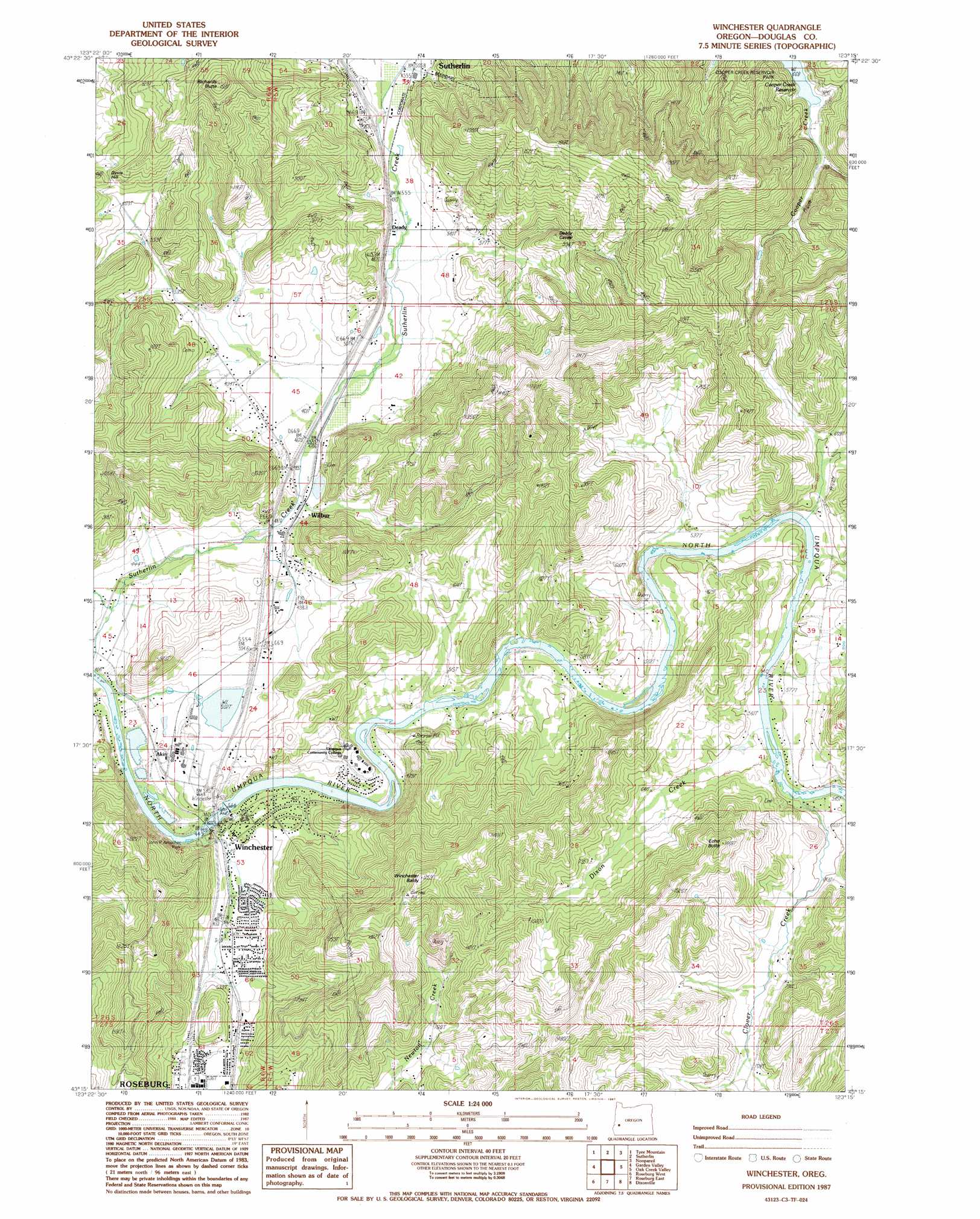
USGS Topo Quad 43123c3 - 1:24,000 scale
| Topo Map Name: | Winchester |
| USGS Topo Quad ID: | 43123c3 |
| Print Size: | ca. 21 1/4" wide x 27" high |
| Southeast Coordinates: | 43.25° N latitude / 123.25° W longitude |
| Map Center Coordinates: | 43.3125° N latitude / 123.3125° W longitude |
| U.S. State: | OR |
| Filename: | o43123c3.jpg |
| Download Map JPG Image: | Winchester topo map 1:24,000 scale |
| Map Type: | Topographic |
| Topo Series: | 7.5´ |
| Map Scale: | 1:24,000 |
| Source of Map Images: | United States Geological Survey (USGS) |
| Alternate Map Versions: |
Winchester OR 1987, updated 1987 Download PDF Buy paper map Winchester OR 2011 Download PDF Buy paper map Winchester OR 2014 Download PDF Buy paper map |
1:24,000 Topo Quads surrounding Winchester
Kellogg |
Yellow Butte |
Yoncalla |
Scotts Valley |
Harness Mountain |
Tyee |
Tyee Mountain |
Sutherlin |
Nonpareil |
Hinkle Creek |
Callahan |
Garden Valley |
Winchester |
Oak Creek Valley |
Glide |
Reston |
Roseburg West |
Roseburg East |
Dixonville |
Lane Mountain |
Tenmile |
Winston |
Myrtle Creek |
Dodson Butte |
White Rock |
> Back to 43123a1 at 1:100,000 scale
> Back to 43122a1 at 1:250,000 scale
> Back to U.S. Topo Maps home
Winchester topo map: Gazetteer
Winchester: Dams
Mar-Linn Timber Corporation Log Pond Dike elevation 154m 505′Winchester Dam elevation 138m 452′
Winchester: Parks
Amacher County Park elevation 129m 423′Winchester: Populated Places
Wilbur elevation 143m 469′Winchester elevation 140m 459′
Winchester: Post Offices
Omro Post Office (historical) elevation 240m 787′Wilbur Post Office elevation 143m 469′
Winchester Post Office elevation 140m 459′
Winchester: Reservoirs
Mar-Linn Log Pond elevation 154m 505′Mar-Linn Timber Corporation Log Pond elevation 154m 505′
Winchester Reservoir elevation 138m 452′
Winchester: Streams
Clover Creek elevation 170m 557′Cooper Creek elevation 153m 501′
Davis Creek elevation 136m 446′
Dixon Creek elevation 164m 538′
Short Creek elevation 141m 462′
Winchester: Summits
Davis Hill elevation 218m 715′Echo Butte elevation 428m 1404′
Richards Butte elevation 440m 1443′
Winchester Baldy elevation 503m 1650′
Winchester digital topo map on disk
Buy this Winchester topo map showing relief, roads, GPS coordinates and other geographical features, as a high-resolution digital map file on DVD: