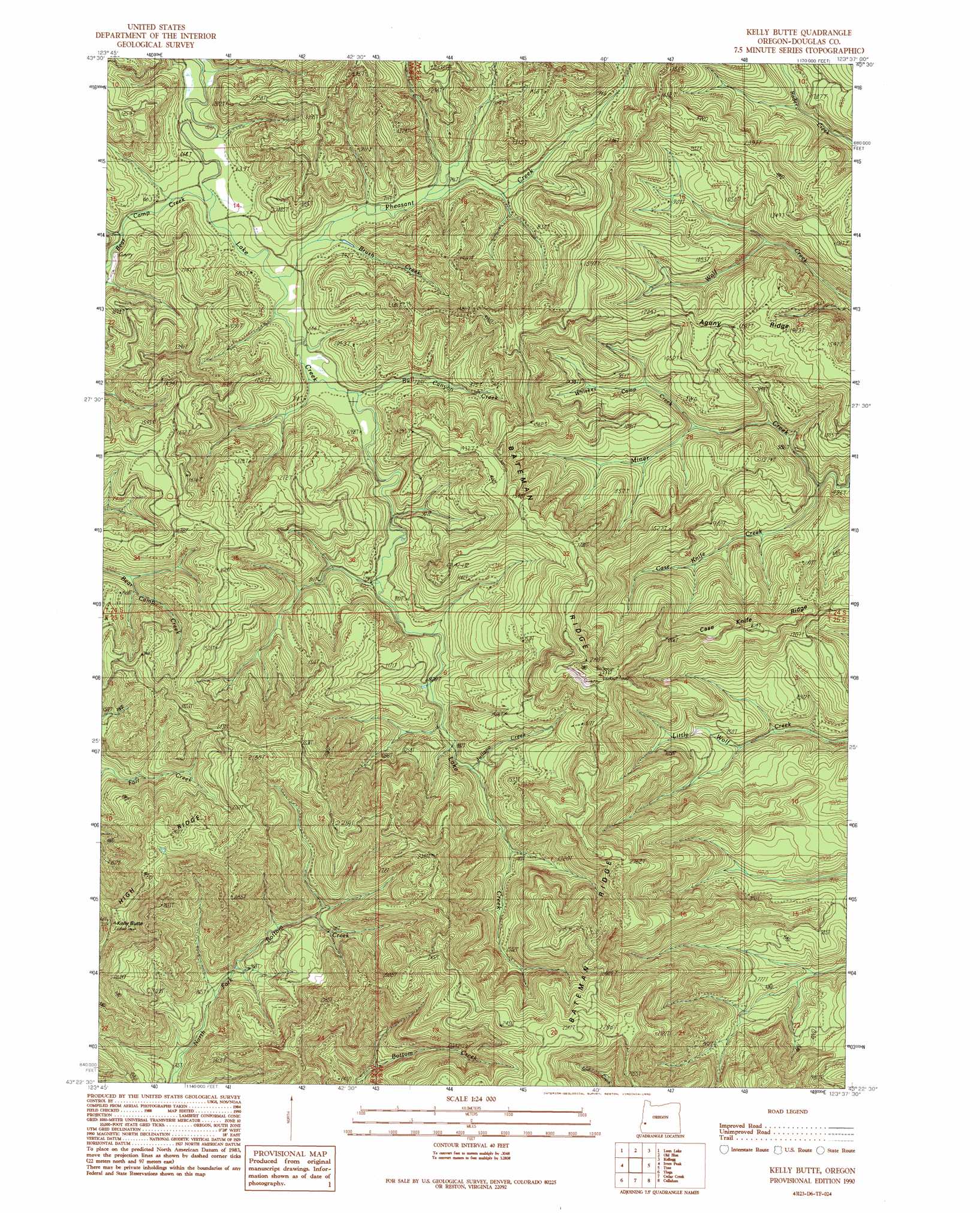
Kelly Butte Topo Map Oregon
To zoom in, hover over the map of Kelly Butte
USGS Topo Quad 43123d6 - 1:24,000 scale
| Topo Map Name: | Kelly Butte |
| USGS Topo Quad ID: | 43123d6 |
| Print Size: | ca. 21 1/4" wide x 27" high |
| Southeast Coordinates: | 43.375° N latitude / 123.625° W longitude |
| Map Center Coordinates: | 43.4375° N latitude / 123.6875° W longitude |
| U.S. State: | OR |
| Filename: | o43123d6.jpg |
| Download Map JPG Image: | Kelly Butte topo map 1:24,000 scale |
| Map Type: | Topographic |
| Topo Series: | 7.5´ |
| Map Scale: | 1:24,000 |
| Source of Map Images: | United States Geological Survey (USGS) |
| Alternate Map Versions: |
Kelly Butte OR 1990, updated 1990 Download PDF Buy paper map Kelly Butte OR 2011 Download PDF Buy paper map Kelly Butte OR 2014 Download PDF Buy paper map |
1:24,000 Topo Quads surrounding Kelly Butte
Deer Head Point |
Scottsburg |
Devils Graveyard |
Elkton |
Putnam Valley |
Eck Peak |
Loon Lake |
Old Blue |
Kellogg |
Yellow Butte |
Golden Falls |
Ivers Peak |
Kelly Butte |
Tyee |
Tyee Mountain |
Coos Mountain |
Tioga |
Cedar Creek |
Callahan |
Garden Valley |
Dora |
Sitkum |
Mount Gurney |
Reston |
Roseburg West |
> Back to 43123a1 at 1:100,000 scale
> Back to 43122a1 at 1:250,000 scale
> Back to U.S. Topo Maps home
Kelly Butte topo map: Gazetteer
Kelly Butte: Ridges
Bateman Ridge elevation 688m 2257′Case Knife Ridge elevation 420m 1377′
Kelly Butte: Streams
Brush Creek elevation 195m 639′Bull Canyon Creek elevation 201m 659′
Case Knife Creek elevation 194m 636′
Juliano Creek elevation 275m 902′
Pheasant Creek elevation 193m 633′
Whiskey Camp Creek elevation 195m 639′
Kelly Butte: Summits
Kelly Butte elevation 775m 2542′Kelly Butte digital topo map on disk
Buy this Kelly Butte topo map showing relief, roads, GPS coordinates and other geographical features, as a high-resolution digital map file on DVD: