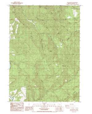
Yellow Butte Topo Map Oregon
To zoom in, hover over the map of Yellow Butte
USGS Topo Quad 43123e4 - 1:24,000 scale
| Topo Map Name: | Yellow Butte |
| USGS Topo Quad ID: | 43123e4 |
| Print Size: | ca. 21 1/4" wide x 27" high |
| Southeast Coordinates: | 43.5° N latitude / 123.375° W longitude |
| Map Center Coordinates: | 43.5625° N latitude / 123.4375° W longitude |
| U.S. State: | OR |
| Filename: | o43123e4.jpg |
| Download Map JPG Image: | Yellow Butte topo map 1:24,000 scale |
| Map Type: | Topographic |
| Topo Series: | 7.5´ |
| Map Scale: | 1:24,000 |
| Source of Map Images: | United States Geological Survey (USGS) |
| Alternate Map Versions: |
Yellow Butte OR 1987, updated 1987 Download PDF Buy paper map Yellow Butte OR 2011 Download PDF Buy paper map Yellow Butte OR 2014 Download PDF Buy paper map |
1:24,000 Topo Quads surrounding Yellow Butte
> Back to 43123e1 at 1:100,000 scale
> Back to 43122a1 at 1:250,000 scale
> Back to U.S. Topo Maps home
Yellow Butte topo map: Gazetteer
Yellow Butte: Flats
Rice Flat elevation 447m 1466′Yellow Butte: Ridges
Bell Ridge elevation 397m 1302′Broken Back Ridge elevation 630m 2066′
Dead Horse Ridge elevation 648m 2125′
Fern Ridge elevation 382m 1253′
Green Ridge elevation 432m 1417′
Middle Ridge elevation 473m 1551′
Renhaven Ridge elevation 566m 1856′
Yellow Butte: Streams
Bear Creek elevation 166m 544′Blue Hole Creek elevation 140m 459′
Doe Creek elevation 187m 613′
Green Ridge Creek elevation 183m 600′
Squaw Creek elevation 113m 370′
Yellow Butte: Summits
Bell Mountain elevation 535m 1755′Blue Buck Mountain elevation 598m 1961′
Buck Mountain elevation 552m 1811′
Deadman Butte elevation 456m 1496′
Prince Albert elevation 676m 2217′
Yellow Butte elevation 716m 2349′
Yellow Butte: Valleys
Snail Canyon elevation 222m 728′Yellow Butte digital topo map on disk
Buy this Yellow Butte topo map showing relief, roads, GPS coordinates and other geographical features, as a high-resolution digital map file on DVD:


