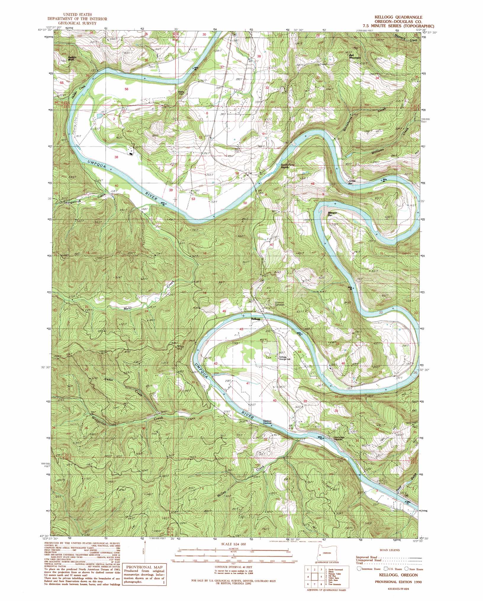
Kellogg Topo Map Oregon
To zoom in, hover over the map of Kellogg
USGS Topo Quad 43123e5 - 1:24,000 scale
| Topo Map Name: | Kellogg |
| USGS Topo Quad ID: | 43123e5 |
| Print Size: | ca. 21 1/4" wide x 27" high |
| Southeast Coordinates: | 43.5° N latitude / 123.5° W longitude |
| Map Center Coordinates: | 43.5625° N latitude / 123.5625° W longitude |
| U.S. State: | OR |
| Filename: | o43123e5.jpg |
| Download Map JPG Image: | Kellogg topo map 1:24,000 scale |
| Map Type: | Topographic |
| Topo Series: | 7.5´ |
| Map Scale: | 1:24,000 |
| Source of Map Images: | United States Geological Survey (USGS) |
| Alternate Map Versions: |
Kellogg OR 1990, updated 1990 Download PDF Buy paper map Kellogg OR 2011 Download PDF Buy paper map Kellogg OR 2014 Download PDF Buy paper map |
1:24,000 Topo Quads surrounding Kellogg
Smith River Falls |
Twin Sisters |
Gunter |
Beaver Creek |
Letz Creek |
Scottsburg |
Devils Graveyard |
Elkton |
Putnam Valley |
Drain |
Loon Lake |
Old Blue |
Kellogg |
Yellow Butte |
Yoncalla |
Ivers Peak |
Kelly Butte |
Tyee |
Tyee Mountain |
Sutherlin |
Tioga |
Cedar Creek |
Callahan |
Garden Valley |
Winchester |
> Back to 43123e1 at 1:100,000 scale
> Back to 43122a1 at 1:250,000 scale
> Back to U.S. Topo Maps home
Kellogg topo map: Gazetteer
Kellogg: Airports
Elkton Airfield elevation 37m 121′Kellogg: Bars
Jones Bar elevation 43m 141′Maupin Bar elevation 48m 157′
Kellogg: Crossings
Smith Ferry (historical) elevation 28m 91′Kellogg: Parks
Hutchinson State Park elevation 62m 203′Madison County Wayside elevation 142m 465′
Kellogg: Populated Places
Kellogg elevation 61m 200′Kellogg: Post Offices
Center Bend Post Office (historical) elevation 28m 91′Hillside Post Office (historical) elevation 83m 272′
Kellogg Post Office (historical) elevation 61m 200′
Kellogg: Rapids
Smith Ferry Rapids elevation 34m 111′Kellogg: Reservoirs
Rattlesnake Gulch Reservoir elevation 61m 200′Kellogg: Streams
Brads Creek elevation 42m 137′Cedar Creek elevation 89m 291′
Fitzpatrick Creek elevation 51m 167′
Heddin Creek elevation 30m 98′
Martin Creek elevation 49m 160′
McGee Creek elevation 62m 203′
Mehl Creek elevation 58m 190′
Tapp Creek elevation 56m 183′
Waggoner Creek elevation 69m 226′
Whitehorse Creek elevation 43m 141′
Williams Creek elevation 42m 137′
Kellogg: Summits
Heddin Bluff elevation 289m 948′Kellogg: Valleys
Deep Gulch elevation 69m 226′Kellogg digital topo map on disk
Buy this Kellogg topo map showing relief, roads, GPS coordinates and other geographical features, as a high-resolution digital map file on DVD: