Eck Peak Topo Map Oregon
To zoom in, hover over the map of Eck Peak
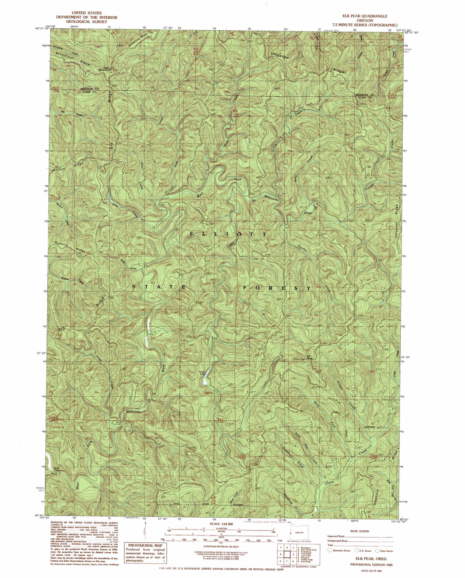
USGS Topo Quad 43123e8 - 1:24,000 scale
| Topo Map Name: | Eck Peak |
| USGS Topo Quad ID: | 43123e8 |
| Print Size: | ca. 21 1/4" wide x 27" high |
| Southeast Coordinates: | 43.5° N latitude / 123.875° W longitude |
| Map Center Coordinates: | 43.5625° N latitude / 123.9375° W longitude |
| U.S. State: | OR |
| Filename: | o43123e8.jpg |
| Download Map JPG Image: | Eck Peak topo map 1:24,000 scale |
| Map Type: | Topographic |
| Topo Series: | 7.5´ |
| Map Scale: | 1:24,000 |
| Source of Map Images: | United States Geological Survey (USGS) |
| Alternate Map Versions: |
Elk Peak OR 1985, updated 1985 Download PDF Buy paper map Elk Peak OR 2011 Download PDF Buy paper map Elk Peak OR 2014 Download PDF Buy paper map |
1:24,000 Topo Quads surrounding Eck Peak
Tahkenitch Creek |
Fivemile Creek |
North Fork |
Smith River Falls |
Twin Sisters |
Winchester Bay |
Reedsport |
Deer Head Point |
Scottsburg |
Devils Graveyard |
Lakeside |
Trail Butte |
Eck Peak |
Loon Lake |
Old Blue |
North Bend |
Allegany |
Golden Falls |
Ivers Peak |
Kelly Butte |
Coos Bay |
Daniels Creek |
Coos Mountain |
Tioga |
Cedar Creek |
> Back to 43123e1 at 1:100,000 scale
> Back to 43122a1 at 1:250,000 scale
> Back to U.S. Topo Maps home
Eck Peak topo map: Gazetteer
Eck Peak: Falls
Stulls Falls elevation 135m 442′Eck Peak: Forests
Elliott State Forest elevation 371m 1217′Eck Peak: Lakes
Gould Lake elevation 359m 1177′Eck Peak: Ridges
Umpcoos Ridge elevation 364m 1194′Eck Peak: Streams
Buck Creek elevation 220m 721′Cedar Creek elevation 276m 905′
Cleighton Creek elevation 228m 748′
Deer Creek elevation 244m 800′
Elk Creek elevation 265m 869′
Fish Creek elevation 265m 869′
Howell Creek elevation 256m 839′
Joes Creek elevation 239m 784′
Kelly Creek elevation 307m 1007′
Knife Creek elevation 255m 836′
Otter Creek elevation 243m 797′
Panther Creek elevation 299m 980′
Slide Out Creek elevation 230m 754′
Trout Creek elevation 186m 610′
West Fork Glenn Creek elevation 245m 803′
Eck Peak: Summits
Dear Mountain elevation 552m 1811′Elk Peak elevation 625m 2050′
Eck Peak digital topo map on disk
Buy this Eck Peak topo map showing relief, roads, GPS coordinates and other geographical features, as a high-resolution digital map file on DVD: