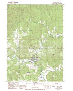
Drain Topo Map Oregon
To zoom in, hover over the map of Drain
USGS Topo Quad 43123f3 - 1:24,000 scale
| Topo Map Name: | Drain |
| USGS Topo Quad ID: | 43123f3 |
| Print Size: | ca. 21 1/4" wide x 27" high |
| Southeast Coordinates: | 43.625° N latitude / 123.25° W longitude |
| Map Center Coordinates: | 43.6875° N latitude / 123.3125° W longitude |
| U.S. State: | OR |
| Filename: | o43123f3.jpg |
| Download Map JPG Image: | Drain topo map 1:24,000 scale |
| Map Type: | Topographic |
| Topo Series: | 7.5´ |
| Map Scale: | 1:24,000 |
| Source of Map Images: | United States Geological Survey (USGS) |
| Alternate Map Versions: |
Drain OR 1987, updated 1987 Download PDF Buy paper map Drain OR 2011 Download PDF Buy paper map Drain OR 2014 Download PDF Buy paper map |
1:24,000 Topo Quads surrounding Drain
> Back to 43123e1 at 1:100,000 scale
> Back to 43122a1 at 1:250,000 scale
> Back to U.S. Topo Maps home
Drain topo map: Gazetteer
Drain: Bridges
Homes Gallup Bridge elevation 86m 282′Drain: Dams
Drain Plywood Company Dam elevation 97m 318′Mount Baldy Log Pond Dam elevation 101m 331′
Smith River Lumber Company Dam elevation 97m 318′
Drain: Gaps
Windy Gap elevation 356m 1167′Drain: Parks
Anna Drain County Park elevation 108m 354′Jessie Applegate Historical Marker elevation 102m 334′
Drain: Populated Places
Drain elevation 89m 291′Leona elevation 98m 321′
Drain: Post Offices
Boswell Post Office (historical) elevation 102m 334′Drain Post Office elevation 89m 291′
Hudson Post Office (historical) elevation 104m 341′
Leona Post Office (historical) elevation 98m 321′
Pass Creek Post Office (historical) elevation 102m 334′
Drain: Reservoirs
Drain Plywood Company Log Pond elevation 97m 318′Farman Creek Reservoir elevation 334m 1095′
Little Reservoir Number Five elevation 97m 318′
Mount Baldy Log Pond elevation 101m 331′
Smith River Log Pond elevation 82m 269′
Smith River Lumber Company Log Pond elevation 97m 318′
Drain: Springs
Boswell Springs elevation 97m 318′Reels Springs elevation 203m 666′
Drain: Streams
Asker Creek elevation 102m 334′Bear Creek elevation 147m 482′
Billy Creek elevation 84m 275′
Ellenburg Creek elevation 115m 377′
Fitch Creek elevation 98m 321′
Hardscrable Creek elevation 74m 242′
Hendrick Creek elevation 99m 324′
Johnson Creek elevation 97m 318′
Krewson Creek elevation 95m 311′
Little Sand Creek elevation 107m 351′
McClintock Creek elevation 99m 324′
Pass Creek elevation 86m 282′
Post Creek elevation 84m 275′
Rock Creek elevation 99m 324′
Sand Creek elevation 99m 324′
Smith Creek elevation 98m 321′
Wise Creek elevation 100m 328′
Yoncalla Creek elevation 100m 328′
Drain: Summits
Bear Hill elevation 420m 1377′Drain Hill elevation 258m 846′
Green Mountain elevation 469m 1538′
Mount Yoncalla elevation 550m 1804′
Sheep Hill elevation 394m 1292′
Drain: Valleys
Dodge Canyon elevation 110m 360′Drain digital topo map on disk
Buy this Drain topo map showing relief, roads, GPS coordinates and other geographical features, as a high-resolution digital map file on DVD:


