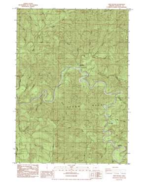
Twin Sisters Topo Map Oregon
To zoom in, hover over the map of Twin Sisters
USGS Topo Quad 43123g6 - 1:24,000 scale
| Topo Map Name: | Twin Sisters |
| USGS Topo Quad ID: | 43123g6 |
| Print Size: | ca. 21 1/4" wide x 27" high |
| Southeast Coordinates: | 43.75° N latitude / 123.625° W longitude |
| Map Center Coordinates: | 43.8125° N latitude / 123.6875° W longitude |
| U.S. State: | OR |
| Filename: | o43123g6.jpg |
| Download Map JPG Image: | Twin Sisters topo map 1:24,000 scale |
| Map Type: | Topographic |
| Topo Series: | 7.5´ |
| Map Scale: | 1:24,000 |
| Source of Map Images: | United States Geological Survey (USGS) |
| Alternate Map Versions: |
Twin Sisters OR 1984, updated 1984 Download PDF Buy paper map Twin Sisters OR 2011 Download PDF Buy paper map Twin Sisters OR 2014 Download PDF Buy paper map |
1:24,000 Topo Quads surrounding Twin Sisters
> Back to 43123e1 at 1:100,000 scale
> Back to 43122a1 at 1:250,000 scale
> Back to U.S. Topo Maps home
Twin Sisters topo map: Gazetteer
Twin Sisters: Areas
Oxbow Burn elevation 145m 475′Twin Sisters: Ridges
Scare Ridge elevation 457m 1499′Twin Sisters: Streams
Argue Creek elevation 149m 488′Beaver Creek elevation 73m 239′
Beaver Creek elevation 134m 439′
Big Creek elevation 128m 419′
Blind Creek elevation 138m 452′
Carpenter Creek elevation 68m 223′
Coldwater Creek elevation 66m 216′
Devils Club Creek elevation 105m 344′
Gold Creek elevation 146m 479′
Herb Creek elevation 117m 383′
Marsh Creek elevation 117m 383′
Moore Creek elevation 99m 324′
Mosetown Creek elevation 133m 436′
North Sister Creek elevation 87m 285′
Rock Creek elevation 126m 413′
Russell Creek elevation 92m 301′
South Sister Creek elevation 84m 275′
Sweden Creek elevation 110m 360′
Twin Sisters: Trails
Twin Sisters Trail elevation 114m 374′Twin Sisters digital topo map on disk
Buy this Twin Sisters topo map showing relief, roads, GPS coordinates and other geographical features, as a high-resolution digital map file on DVD:


