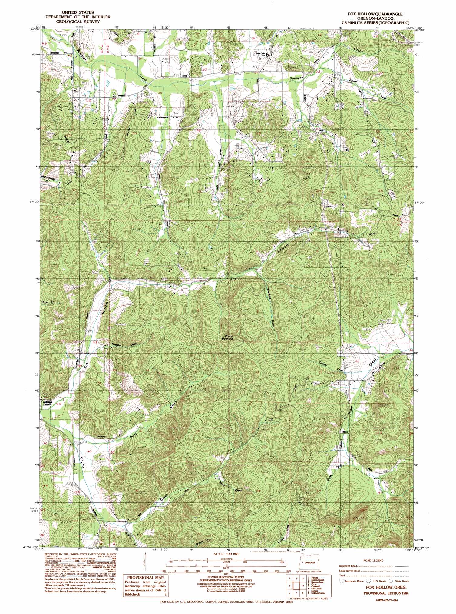
Fox Hollow Topo Map Oregon
To zoom in, hover over the map of Fox Hollow
USGS Topo Quad 43123h2 - 1:24,000 scale
| Topo Map Name: | Fox Hollow |
| USGS Topo Quad ID: | 43123h2 |
| Print Size: | ca. 21 1/4" wide x 27" high |
| Southeast Coordinates: | 43.875° N latitude / 123.125° W longitude |
| Map Center Coordinates: | 43.9375° N latitude / 123.1875° W longitude |
| U.S. State: | OR |
| Filename: | o43123h2.jpg |
| Download Map JPG Image: | Fox Hollow topo map 1:24,000 scale |
| Map Type: | Topographic |
| Topo Series: | 7.5´ |
| Map Scale: | 1:24,000 |
| Source of Map Images: | United States Geological Survey (USGS) |
| Alternate Map Versions: |
Fox Hollow OR 1984, updated 1984 Download PDF Buy paper map Fox Hollow OR 2011 Download PDF Buy paper map Fox Hollow OR 2014 Download PDF Buy paper map |
1:24,000 Topo Quads surrounding Fox Hollow
Horton |
Cheshire |
Junction City |
Coburg |
Mohawk |
Noti |
Veneta |
Eugene West |
Eugene East |
Springfield |
High Point |
Crow |
Fox Hollow |
Creswell |
Jasper |
Beaver Creek |
Letz Creek |
Lorane |
Cottage Grove |
Dorena Lake |
Putnam Valley |
Drain |
Curtin |
Cottage Grove Lake |
Blue Mountain |
> Back to 43123e1 at 1:100,000 scale
> Back to 43122a1 at 1:250,000 scale
> Back to U.S. Topo Maps home
Fox Hollow topo map: Gazetteer
Fox Hollow: Populated Places
Fox Hollow (historical) elevation 180m 590′Siuslaw (historical) elevation 186m 610′
Fox Hollow: Post Offices
Fox Hollow Post Office (historical) elevation 180m 590′Siuslaw Post Office (historical) elevation 159m 521′
Spencer Creek Post Office (historical) elevation 138m 452′
Spencers Butte Post Office (historical) elevation 203m 666′
Fox Hollow: Streams
Boardtree Creek elevation 206m 675′Doak Creek elevation 158m 518′
Jackson Creek elevation 172m 564′
Preacher Creek elevation 159m 521′
Rebel Creek elevation 209m 685′
Skunk Creek elevation 208m 682′
South Fork Spencer Creek elevation 144m 472′
Truman Creek elevation 193m 633′
Fox Hollow: Summits
Briggs Hill elevation 306m 1003′Round Mountain elevation 415m 1361′
Fox Hollow: Valleys
Fox Hollow elevation 154m 505′Fox Hollow digital topo map on disk
Buy this Fox Hollow topo map showing relief, roads, GPS coordinates and other geographical features, as a high-resolution digital map file on DVD: