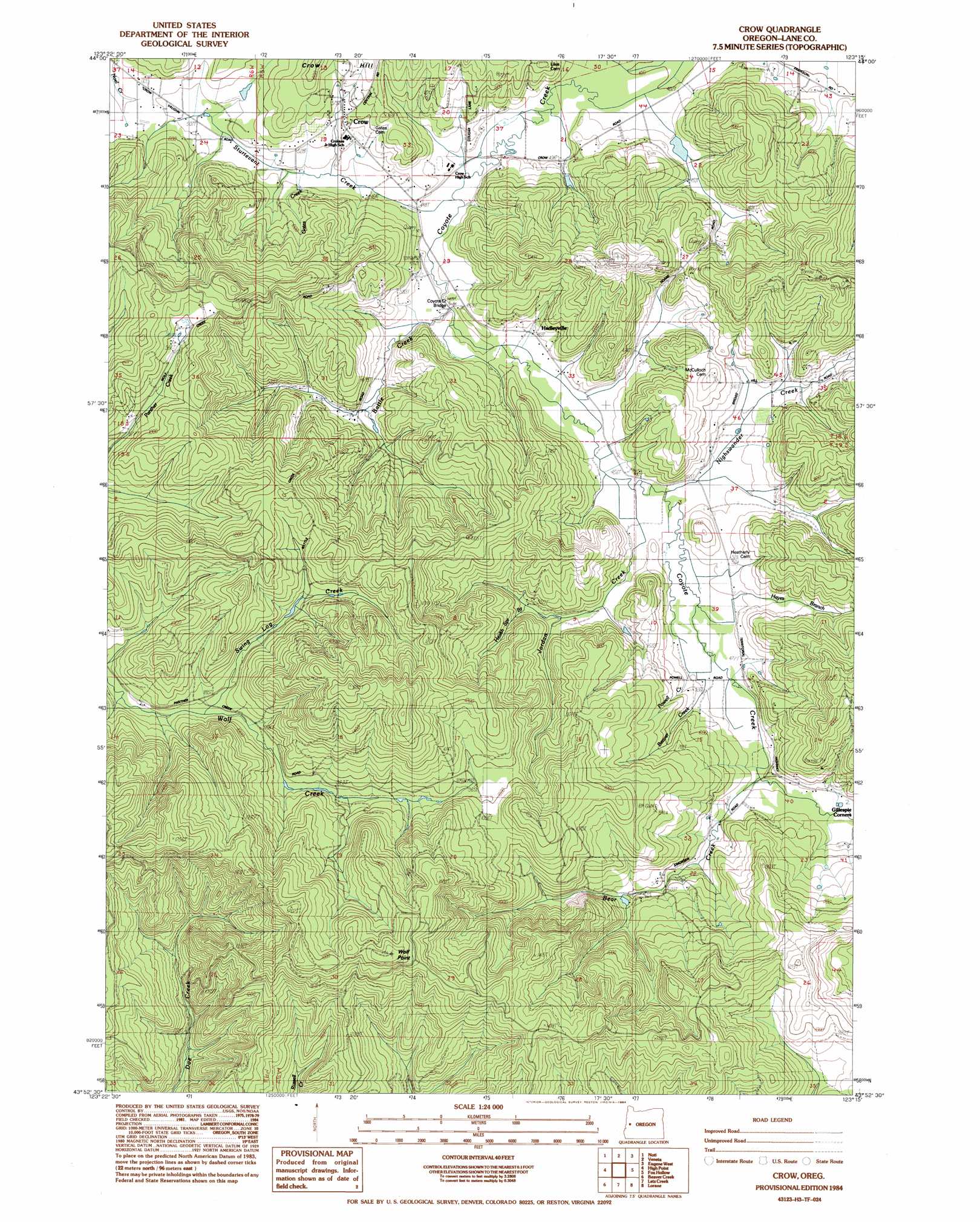
Crow Topo Map Oregon
To zoom in, hover over the map of Crow
USGS Topo Quad 43123h3 - 1:24,000 scale
| Topo Map Name: | Crow |
| USGS Topo Quad ID: | 43123h3 |
| Print Size: | ca. 21 1/4" wide x 27" high |
| Southeast Coordinates: | 43.875° N latitude / 123.25° W longitude |
| Map Center Coordinates: | 43.9375° N latitude / 123.3125° W longitude |
| U.S. State: | OR |
| Filename: | o43123h3.jpg |
| Download Map JPG Image: | Crow topo map 1:24,000 scale |
| Map Type: | Topographic |
| Topo Series: | 7.5´ |
| Map Scale: | 1:24,000 |
| Source of Map Images: | United States Geological Survey (USGS) |
| Alternate Map Versions: |
Crow OR 1984, updated 1984 Download PDF Buy paper map Crow OR 2011 Download PDF Buy paper map Crow OR 2014 Download PDF Buy paper map |
1:24,000 Topo Quads surrounding Crow
Triangle Lake |
Horton |
Cheshire |
Junction City |
Coburg |
Walton |
Noti |
Veneta |
Eugene West |
Eugene East |
Clay Creek |
High Point |
Crow |
Fox Hollow |
Creswell |
Gunter |
Beaver Creek |
Letz Creek |
Lorane |
Cottage Grove |
Elkton |
Putnam Valley |
Drain |
Curtin |
Cottage Grove Lake |
> Back to 43123e1 at 1:100,000 scale
> Back to 43122a1 at 1:250,000 scale
> Back to U.S. Topo Maps home
Crow topo map: Gazetteer
Crow: Areas
Shaw Burn elevation 316m 1036′Crow: Bridges
Coyote Creek Bridge elevation 134m 439′Crow: Dams
Ford Farms Dam elevation 134m 439′Crow: Populated Places
Crow elevation 175m 574′Hadleyville elevation 134m 439′
Crow: Post Offices
Crow Post Office (historical) elevation 175m 574′Hadleyville Post Office (historical) elevation 134m 439′
Mirth Post Office (historical) elevation 195m 639′
Crow: Reservoirs
Ford Farms Reservoir elevation 134m 439′Smith Reservoir elevation 147m 482′
Crow: Streams
Battle Creek elevation 135m 442′Bear Creek elevation 143m 469′
Beaver Creek elevation 141m 462′
Chicken Whistle Creek elevation 172m 564′
Gates Creek elevation 145m 475′
Hayes Branch elevation 141m 462′
Jordan Creek elevation 141m 462′
Nighswander Creek elevation 150m 492′
Powell Branch elevation 145m 475′
Sturtevant Creek elevation 130m 426′
Swing Log Creek elevation 264m 866′
West Fork Battle Creek elevation 144m 472′
Crow: Summits
Crow Hill elevation 258m 846′Wolf Point elevation 517m 1696′
Crow digital topo map on disk
Buy this Crow topo map showing relief, roads, GPS coordinates and other geographical features, as a high-resolution digital map file on DVD: