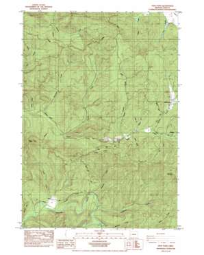
High Point Topo Map Oregon
To zoom in, hover over the map of High Point
USGS Topo Quad 43123h4 - 1:24,000 scale
| Topo Map Name: | High Point |
| USGS Topo Quad ID: | 43123h4 |
| Print Size: | ca. 21 1/4" wide x 27" high |
| Southeast Coordinates: | 43.875° N latitude / 123.375° W longitude |
| Map Center Coordinates: | 43.9375° N latitude / 123.4375° W longitude |
| U.S. State: | OR |
| Filename: | o43123h4.jpg |
| Download Map JPG Image: | High Point topo map 1:24,000 scale |
| Map Type: | Topographic |
| Topo Series: | 7.5´ |
| Map Scale: | 1:24,000 |
| Source of Map Images: | United States Geological Survey (USGS) |
| Alternate Map Versions: |
High Point OR 1984, updated 1984 Download PDF Buy paper map High Point OR 2011 Download PDF Buy paper map High Point OR 2014 Download PDF Buy paper map |
1:24,000 Topo Quads surrounding High Point
> Back to 43123e1 at 1:100,000 scale
> Back to 43122a1 at 1:250,000 scale
> Back to U.S. Topo Maps home
High Point topo map: Gazetteer
High Point: Capes
Stony Point elevation 569m 1866′High Point: Populated Places
Alma elevation 178m 583′Mound (historical) elevation 229m 751′
Wolf Creek elevation 254m 833′
High Point: Post Offices
Alma Post Office (historical) elevation 178m 583′Mound Post Office (historical) elevation 229m 751′
Panther Post Office (historical) elevation 248m 813′
High Point: Reservoirs
Carrol Reservoir elevation 179m 587′High Point: Ridges
Timber Ridge elevation 406m 1332′High Point: Streams
Beaver Creek elevation 230m 754′Cabin Creek elevation 227m 744′
Camp Creek elevation 152m 498′
Conger Creek elevation 161m 528′
Deer Creek elevation 231m 757′
Doc Hollow Creek elevation 165m 541′
Dogwood Creek elevation 156m 511′
Eames Creek elevation 179m 587′
Elkhorn Creek elevation 244m 800′
Fish Creek elevation 244m 800′
Greenshaw Creek elevation 169m 554′
Holland Creek elevation 159m 521′
Lewis Creek elevation 252m 826′
Panther Creek elevation 232m 761′
Pheasant Creek elevation 157m 515′
Swamp Creek elevation 236m 774′
Tunnel Creek elevation 169m 554′
High Point: Summits
High Point elevation 547m 1794′High Point digital topo map on disk
Buy this High Point topo map showing relief, roads, GPS coordinates and other geographical features, as a high-resolution digital map file on DVD:


