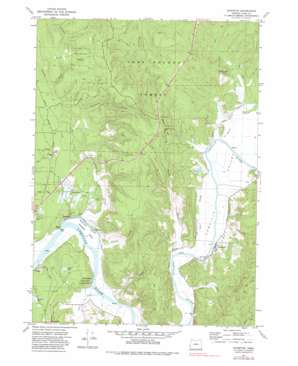
Riverton Topo Map Oregon
To zoom in, hover over the map of Riverton
USGS Topo Quad 43124b3 - 1:24,000 scale
| Topo Map Name: | Riverton |
| USGS Topo Quad ID: | 43124b3 |
| Print Size: | ca. 21 1/4" wide x 27" high |
| Southeast Coordinates: | 43.125° N latitude / 124.25° W longitude |
| Map Center Coordinates: | 43.1875° N latitude / 124.3125° W longitude |
| U.S. State: | OR |
| Filename: | o43124b3.jpg |
| Download Map JPG Image: | Riverton topo map 1:24,000 scale |
| Map Type: | Topographic |
| Topo Series: | 7.5´ |
| Map Scale: | 1:24,000 |
| Source of Map Images: | United States Geological Survey (USGS) |
| Alternate Map Versions: |
Riverton OR 1971, updated 1973 Download PDF Buy paper map Riverton OR 1971, updated 1983 Download PDF Buy paper map Riverton OR 2011 Download PDF Buy paper map Riverton OR 2014 Download PDF Buy paper map |
1:24,000 Topo Quads surrounding Riverton
> Back to 43124a1 at 1:100,000 scale
> Back to 43124a1 at 1:250,000 scale
> Back to U.S. Topo Maps home
Riverton topo map: Gazetteer
Riverton: Capes
Rocky Point elevation 4m 13′Riverton: Forests
Coos County Forest elevation 56m 183′Riverton: Guts
Randolph Slough elevation 3m 9′Riverton: Islands
Randolph Island elevation 3m 9′Riverton: Mines
Eagle Mine elevation 63m 206′Rose Mine elevation 134m 439′
Seven Devils Mine elevation 89m 291′
Riverton: Parks
Judah Parker County Park elevation 38m 124′Riverton Boat Ramp elevation 3m 9′
Rocky Point Boat Ramp elevation 7m 22′
Riverton: Populated Places
Leneve elevation 9m 29′Parkersburg elevation 2m 6′
Prosper elevation 4m 13′
Randolph elevation 3m 9′
Riverton elevation 7m 22′
Riverton: Post Offices
Central City Post Office (historical) elevation 10m 32′Freedom Post Office (historical) elevation 3m 9′
Iowa Slough Post Office (historical) elevation 5m 16′
Leneve Post Office (historical) elevation 9m 29′
Parkersburgh Post Office (historical) elevation 2m 6′
Preuss Post Office (historical) elevation 37m 121′
Prosper Post Office (historical) elevation 4m 13′
Randolph Post Office (historical) elevation 3m 9′
Riverton Post Office (historical) elevation 7m 22′
Riverton: Reservoirs
Russell Reservoirs elevation 61m 200′Riverton: Springs
Cannery Spring ck rcd data elevation 71m 232′Martin Spring elevation 46m 150′
Riverton: Streams
Alder Creek elevation 3m 9′Bear Creek elevation 2m 6′
Beaver Slough elevation 3m 9′
Cedar Creek elevation 2m 6′
China Creek elevation 3m 9′
Clear Creek elevation 6m 19′
Hamdock Creek elevation 2m 6′
Hatchet Slough elevation 3m 9′
Hultin Creek elevation 6m 19′
Iowa Slough elevation 3m 9′
Lowe Creek elevation 2m 6′
Offield Creek elevation 3m 9′
Polly Creek elevation 50m 164′
Red Creek elevation 4m 13′
Seestrom Creek elevation 4m 13′
Sevenmile Creek elevation 3m 9′
Sevenmile Slough elevation 3m 9′
Woolsey Creek elevation 3m 9′
Riverton: Summits
Beaver Hill elevation 185m 606′Riverton: Swamps
Caufield Marsh elevation 7m 22′Riverton: Valleys
Caufield Gulch elevation 7m 22′Coquille Valley elevation 3m 9′
Peterson Gulch elevation 5m 16′
Richardson Gulch elevation 3m 9′
Riverton digital topo map on disk
Buy this Riverton topo map showing relief, roads, GPS coordinates and other geographical features, as a high-resolution digital map file on DVD:


