Goose Pasture Topo Map Oregon
To zoom in, hover over the map of Goose Pasture
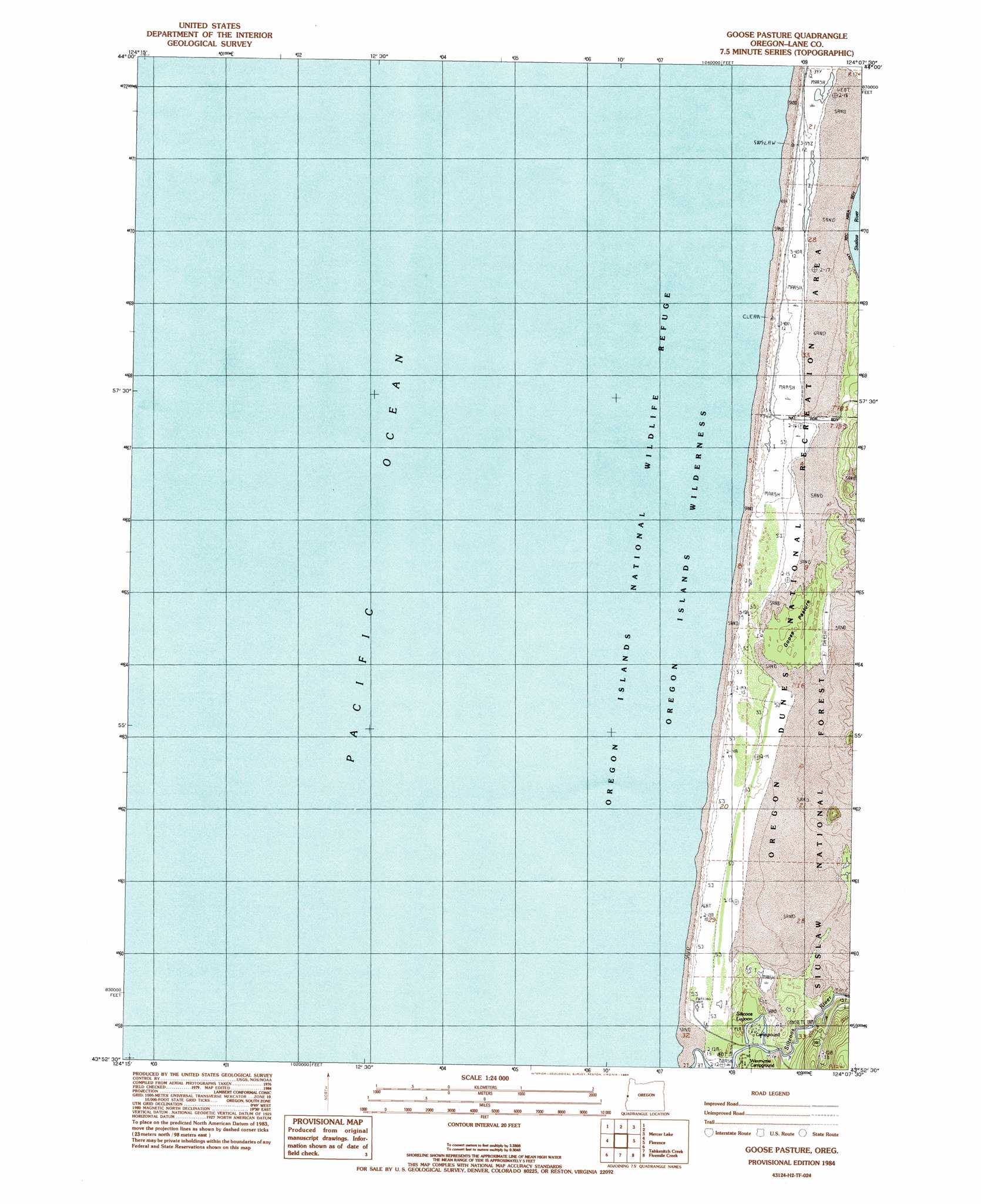
USGS Topo Quad 43124h2 - 1:24,000 scale
| Topo Map Name: | Goose Pasture |
| USGS Topo Quad ID: | 43124h2 |
| Print Size: | ca. 21 1/4" wide x 27" high |
| Southeast Coordinates: | 43.875° N latitude / 124.125° W longitude |
| Map Center Coordinates: | 43.9375° N latitude / 124.1875° W longitude |
| U.S. State: | OR |
| Filename: | o43124h2.jpg |
| Download Map JPG Image: | Goose Pasture topo map 1:24,000 scale |
| Map Type: | Topographic |
| Topo Series: | 7.5´ |
| Map Scale: | 1:24,000 |
| Source of Map Images: | United States Geological Survey (USGS) |
| Alternate Map Versions: |
Goose Pasture OR 1984, updated 1984 Download PDF Buy paper map Goose Pasture OR 2011 Download PDF Buy paper map Goose Pasture OR 2014 Download PDF Buy paper map |
| FStopo: | US Forest Service topo Goose Pasture is available: Download FStopo PDF Download FStopo TIF |
1:24,000 Topo Quads surrounding Goose Pasture
Heceta Head |
Cummins Peak |
|||
Mercer Lake |
Tiernan |
|||
Goose Pasture |
Florence |
Goodwin Peak |
||
Tahkenitch Creek |
Fivemile Creek |
North Fork |
||
Winchester Bay |
Reedsport |
Deer Head Point |
> Back to 43124e1 at 1:100,000 scale
> Back to 43124a1 at 1:250,000 scale
> Back to U.S. Topo Maps home
Goose Pasture topo map: Gazetteer
Goose Pasture: Areas
Goose Pasture elevation 10m 32′Goose Pasture: Dams
Siltcoos Lake Dam elevation 7m 22′Goose Pasture: Lakes
Siltcoos Lagoon elevation 6m 19′Goose Pasture: Swamps
Parking Lot Marsh elevation 6m 19′Goose Pasture digital topo map on disk
Buy this Goose Pasture topo map showing relief, roads, GPS coordinates and other geographical features, as a high-resolution digital map file on DVD: