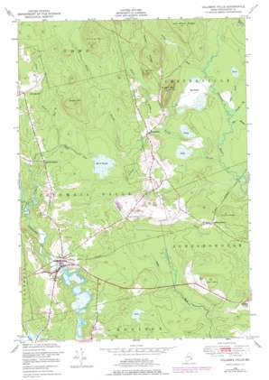
Columbia Falls Topo Map Maine
To zoom in, hover over the map of Columbia Falls
USGS Topo Quad 44067f6 - 1:24,000 scale
| Topo Map Name: | Columbia Falls |
| USGS Topo Quad ID: | 44067f6 |
| Print Size: | ca. 21 1/4" wide x 27" high |
| Southeast Coordinates: | 44.625° N latitude / 67.625° W longitude |
| Map Center Coordinates: | 44.6875° N latitude / 67.6875° W longitude |
| U.S. State: | ME |
| Filename: | o44067f6.jpg |
| Download Map JPG Image: | Columbia Falls topo map 1:24,000 scale |
| Map Type: | Topographic |
| Topo Series: | 7.5´ |
| Map Scale: | 1:24,000 |
| Source of Map Images: | United States Geological Survey (USGS) |
| Alternate Map Versions: |
Columbia Falls ME 1948, updated 1968 Download PDF Buy paper map Columbia Falls ME 1948, updated 1978 Download PDF Buy paper map Columbia Falls ME 1951, updated 1951 Download PDF Buy paper map Columbia Falls ME 2011 Download PDF Buy paper map Columbia Falls ME 2014 Download PDF Buy paper map |
1:24,000 Topo Quads surrounding Columbia Falls
> Back to 44067e1 at 1:100,000 scale
> Back to 44066a1 at 1:250,000 scale
> Back to U.S. Topo Maps home
Columbia Falls topo map: Gazetteer
Columbia Falls: Populated Places
Centerville elevation 31m 101′Columbia Falls elevation 6m 19′
Columbia Falls: Ridges
Jim Wood Ridge elevation 107m 351′Sewall Ridge elevation 95m 311′
Staple Ridge elevation 59m 193′
Columbia Falls: Springs
Green Spring elevation 42m 137′Columbia Falls: Streams
Alder Brook elevation 18m 59′East Branch Chandler River elevation 18m 59′
Johnny B Brook elevation 24m 78′
Kaylor Brook elevation 22m 72′
Libby Brook elevation 21m 68′
Little River elevation 9m 29′
Marst Brook elevation 28m 91′
Pecky Brook elevation 18m 59′
Samade Brook elevation 18m 59′
Sherb Brook elevation 33m 108′
Tenney Brook elevation 24m 78′
Columbia Falls: Summits
Carr Hill elevation 67m 219′Milton Mountain elevation 136m 446′
Oak Hill elevation 105m 344′
Patten Hill elevation 143m 469′
Sugar Hill elevation 124m 406′
Columbia Falls: Swamps
Big Heath elevation 21m 68′Marst Heath elevation 33m 108′
Columbia Falls digital topo map on disk
Buy this Columbia Falls topo map showing relief, roads, GPS coordinates and other geographical features, as a high-resolution digital map file on DVD:
Maine, New Hampshire, Rhode Island & Eastern Massachusetts
Buy digital topo maps: Maine, New Hampshire, Rhode Island & Eastern Massachusetts


