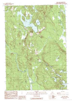
Bog Lake Topo Map Maine
To zoom in, hover over the map of Bog Lake
USGS Topo Quad 44067g5 - 1:24,000 scale
| Topo Map Name: | Bog Lake |
| USGS Topo Quad ID: | 44067g5 |
| Print Size: | ca. 21 1/4" wide x 27" high |
| Southeast Coordinates: | 44.75° N latitude / 67.5° W longitude |
| Map Center Coordinates: | 44.8125° N latitude / 67.5625° W longitude |
| U.S. State: | ME |
| Filename: | o44067g5.jpg |
| Download Map JPG Image: | Bog Lake topo map 1:24,000 scale |
| Map Type: | Topographic |
| Topo Series: | 7.5´ |
| Map Scale: | 1:24,000 |
| Source of Map Images: | United States Geological Survey (USGS) |
| Alternate Map Versions: |
Bog Lake ME 1990, updated 1990 Download PDF Buy paper map Bog Lake ME 2011 Download PDF Buy paper map Bog Lake ME 2014 Download PDF Buy paper map |
1:24,000 Topo Quads surrounding Bog Lake
> Back to 44067e1 at 1:100,000 scale
> Back to 44066a1 at 1:250,000 scale
> Back to U.S. Topo Maps home
Bog Lake topo map: Gazetteer
Bog Lake: Bays
Long Lake Cove elevation 52m 170′Bog Lake: Cliffs
Crooked Pitch elevation 15m 49′Smith Mill Pitch elevation 14m 45′
Bog Lake: Dams
Marks Lake Dam elevation 41m 134′Bog Lake: Falls
Great Falls elevation 22m 72′Bog Lake: Lakes
Bog Lake elevation 52m 170′Fulton Lake elevation 52m 170′
Great Brook Lake elevation 55m 180′
Harmon Lake elevation 68m 223′
Horseshoe Lake elevation 59m 193′
Keeley Lake elevation 62m 203′
Pug Lake elevation 40m 131′
Seavey Lake elevation 78m 255′
Second Marks Lake elevation 63m 206′
Six Mile Lake elevation 65m 213′
Bog Lake: Populated Places
Northfield elevation 76m 249′Smith Landing elevation 25m 82′
Bog Lake: Rapids
Bobsled Rips elevation 20m 65′Getchell Riffles elevation 23m 75′
Lower Riffles elevation 14m 45′
Wigwam Riffles elevation 25m 82′
Bog Lake: Reservoirs
Marks Lake elevation 41m 134′Bog Lake: Ridges
Carry Ridge elevation 82m 269′Long Lake Ridge elevation 105m 344′
Bog Lake: Streams
Bryant Brook elevation 24m 78′Cook Meadow Brook elevation 17m 55′
Great Brook elevation 15m 49′
Huntley Brook elevation 13m 42′
Scott Brook elevation 12m 39′
Tangle Brook elevation 18m 59′
Bog Lake: Summits
Andy Mountain elevation 69m 226′Harmon Mountain elevation 99m 324′
Sumac Hill elevation 79m 259′
Bog Lake: Swamps
Pug Heath elevation 53m 173′Bog Lake digital topo map on disk
Buy this Bog Lake topo map showing relief, roads, GPS coordinates and other geographical features, as a high-resolution digital map file on DVD:
Maine, New Hampshire, Rhode Island & Eastern Massachusetts
Buy digital topo maps: Maine, New Hampshire, Rhode Island & Eastern Massachusetts


