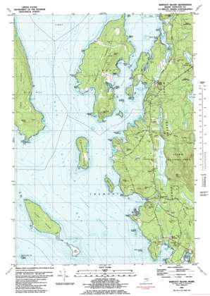
Bartlett Island Topo Map Maine
To zoom in, hover over the map of Bartlett Island
USGS Topo Quad 44068c4 - 1:24,000 scale
| Topo Map Name: | Bartlett Island |
| USGS Topo Quad ID: | 44068c4 |
| Print Size: | ca. 21 1/4" wide x 27" high |
| Southeast Coordinates: | 44.25° N latitude / 68.375° W longitude |
| Map Center Coordinates: | 44.3125° N latitude / 68.4375° W longitude |
| U.S. State: | ME |
| Filename: | o44068c4.jpg |
| Download Map JPG Image: | Bartlett Island topo map 1:24,000 scale |
| Map Type: | Topographic |
| Topo Series: | 7.5´ |
| Map Scale: | 1:24,000 |
| Source of Map Images: | United States Geological Survey (USGS) |
| Alternate Map Versions: |
Bartlett Island ME 1981, updated 1982 Download PDF Buy paper map Bartlett Island ME 2011 Download PDF Buy paper map Bartlett Island ME 2014 Download PDF Buy paper map |
1:24,000 Topo Quads surrounding Bartlett Island
> Back to 44068a1 at 1:100,000 scale
> Back to 44068a1 at 1:250,000 scale
> Back to U.S. Topo Maps home
Bartlett Island topo map: Gazetteer
Bartlett Island: Bars
Cow and Calf Ledge elevation 0m 0′Merman Ledge elevation 4m 13′
Bartlett Island: Bays
Birch Island Cove elevation 0m 0′Crystal Cove elevation 0m 0′
Deep Cove elevation 1m 3′
Dogfish Cove elevation 0m 0′
Duck Cove elevation 0m 0′
Dunhams Cove elevation 0m 0′
Fogg Cove elevation 0m 0′
Goose Cove elevation 0m 0′
Great Cove elevation 0m 0′
Great Cove elevation 0m 0′
Hodgon Cove elevation 0m 0′
Latty Cove elevation 0m 0′
Mill Cove elevation 0m 0′
Pretty Marsh Harbor elevation 0m 0′
Sawyers Cove elevation 0m 0′
Seal Cove elevation 0m 0′
Seal Cove elevation 0m 0′
Somes Cove elevation 0m 0′
Squid Cove elevation 0m 0′
Stewart Cove elevation 0m 0′
Bartlett Island: Capes
Alleys Point elevation 6m 19′Clark Point elevation 9m 29′
Dix Point elevation 12m 39′
Dodge Point elevation 6m 19′
Dogfish Point elevation 6m 19′
Dow Point elevation 2m 6′
Eastern Point elevation 3m 9′
Galley Point elevation 0m 0′
Goose Marsh Point elevation 6m 19′
Ledges Point elevation 3m 9′
Long Island Hub elevation 6m 19′
North Point elevation 14m 45′
Reed Point elevation 4m 13′
Rock Point elevation 3m 9′
Stewart Head elevation 18m 59′
West Point elevation 5m 16′
Western Point elevation 6m 19′
Bartlett Island: Channels
Bartlett Narrows elevation 0m 0′Eastern Passage elevation 0m 0′
Bartlett Island: Cliffs
Lookout Ledge elevation 41m 134′Bartlett Island: Dams
Seal Cove Dam elevation 4m 13′Bartlett Island: Islands
Bar Island elevation 9m 29′Bartlett Island elevation 52m 170′
Birch Island elevation 2m 6′
Folly Island elevation 5m 16′
Goose Cove Rock elevation 1m 3′
Hardwood Island elevation 21m 68′
Johns Island elevation 0m 0′
Moose Island elevation 14m 45′
Rumell Island elevation 2m 6′
Sand Island elevation 0m 0′
Squid Island elevation 0m 0′
The Hub elevation 0m 0′
Tinker Island elevation 24m 78′
Bartlett Island: Lakes
Duck Pond elevation 71m 232′Goose Marsh Pond elevation 0m 0′
Hodgdon Pond elevation 12m 39′
Round Pond elevation 18m 59′
Bartlett Island: Populated Places
Center elevation 27m 88′Pretty Marsh elevation 12m 39′
Seal Cove elevation 14m 45′
West Tremont elevation 20m 65′
Bartlett Island: Post Offices
Seal Cove Post Office elevation 18m 59′Seal Cove Post Office elevation 14m 45′
West Tremont Post Office elevation 15m 49′
Bartlett Island: Reservoirs
Seal Cove Pond elevation 4m 13′Bartlett Island: Ridges
Norwood Ridge elevation 58m 190′Bartlett Island: Streams
Duck Cove Brook elevation 7m 22′Duck Pond Brook elevation 18m 59′
Hodgdon Brook elevation 12m 39′
Steward Brook elevation 2m 6′
Tinker Brook elevation 0m 0′
Webster Brook elevation 0m 0′
Bartlett Island: Summits
Bald Hill elevation 71m 232′Bald Mountain elevation 121m 396′
Billings Hill elevation 43m 141′
Butlers Hill elevation 61m 200′
High Head elevation 28m 91′
Murphy Hill elevation 53m 173′
Oak Hill elevation 67m 219′
Old Field Hill elevation 66m 216′
Pine Hill elevation 57m 187′
Robbins Hill elevation 72m 236′
Steves Hill elevation 68m 223′
Tinker Hill elevation 23m 75′
Uncle Dick Hill elevation 53m 173′
Bartlett Island: Swamps
Goose Marsh elevation 6m 19′Murphy Swamp elevation 15m 49′
Bartlett Island: Trails
South Face Trail elevation 254m 833′Bartlett Island digital topo map on disk
Buy this Bartlett Island topo map showing relief, roads, GPS coordinates and other geographical features, as a high-resolution digital map file on DVD:
Maine, New Hampshire, Rhode Island & Eastern Massachusetts
Buy digital topo maps: Maine, New Hampshire, Rhode Island & Eastern Massachusetts


