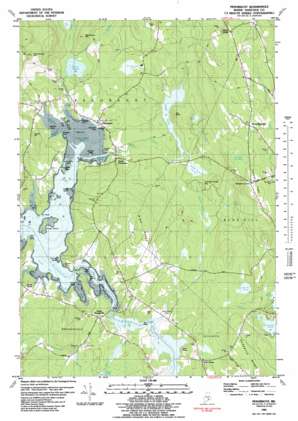
Penobscot Topo Map Maine
To zoom in, hover over the map of Penobscot
USGS Topo Quad 44068d6 - 1:24,000 scale
| Topo Map Name: | Penobscot |
| USGS Topo Quad ID: | 44068d6 |
| Print Size: | ca. 21 1/4" wide x 27" high |
| Southeast Coordinates: | 44.375° N latitude / 68.625° W longitude |
| Map Center Coordinates: | 44.4375° N latitude / 68.6875° W longitude |
| U.S. State: | ME |
| Filename: | o44068d6.jpg |
| Download Map JPG Image: | Penobscot topo map 1:24,000 scale |
| Map Type: | Topographic |
| Topo Series: | 7.5´ |
| Map Scale: | 1:24,000 |
| Source of Map Images: | United States Geological Survey (USGS) |
| Alternate Map Versions: |
Penobscot ME 1981, updated 1981 Download PDF Buy paper map Penobscot ME 1981, updated 1990 Download PDF Buy paper map Penobscot ME 2011 Download PDF Buy paper map Penobscot ME 2014 Download PDF Buy paper map |
1:24,000 Topo Quads surrounding Penobscot
> Back to 44068a1 at 1:100,000 scale
> Back to 44068a1 at 1:250,000 scale
> Back to U.S. Topo Maps home
Penobscot topo map: Gazetteer
Penobscot: Bays
Green Cove elevation 0m 0′Hutchins Cove elevation 0m 0′
Littlefield Cove elevation 0m 0′
Northern Bay elevation 0m 0′
South Bay elevation 0m 0′
Stover Cove elevation 0m 0′
Tapley Cove elevation 0m 0′
Tills Cove elevation 0m 0′
Wardwell Cove elevation 0m 0′
Winslow Cove elevation 0m 0′
Penobscot: Capes
Bridges Point elevation 5m 16′Carpenter Point elevation 13m 42′
Freethy Point elevation 7m 22′
Grindle Point elevation 7m 22′
Hawes Point elevation 6m 19′
Hutchins Point elevation 13m 42′
Johnson Point elevation 24m 78′
Littlefield Point elevation 8m 26′
Mills Point elevation 6m 19′
Tills Point elevation 6m 19′
Wardwell Point elevation 10m 32′
Penobscot: Cliffs
The Bluffs elevation 42m 137′Penobscot: Falls
Bagaduce Falls elevation 6m 19′Penobscot: Islands
Aunt Mollie Island elevation 0m 0′Battle Island elevation 6m 19′
Gravel Island elevation 0m 0′
Green Island elevation 8m 26′
Pumpkin Island elevation 3m 9′
Sparks Island elevation 6m 19′
Winslow Island elevation 6m 19′
Youngs Islands elevation 6m 19′
Penobscot: Lakes
Fourth Pond elevation 33m 108′Pierce Pond elevation 25m 82′
Second Pond elevation 29m 95′
Turtle Pond elevation 28m 91′
Wight Pond elevation 22m 72′
Penobscot: Populated Places
Grays Corner elevation 37m 121′Marks Corner elevation 104m 341′
North Brooksville elevation 20m 65′
Oak Hill elevation 21m 68′
Penobscot elevation 12m 39′
South Penobscot elevation 20m 65′
Stover Corner elevation 15m 49′
Penobscot: Ridges
Gray Ridge elevation 92m 301′Hinckley Ridge elevation 95m 311′
Penobscot: Streams
Camp Stream elevation 3m 9′McCaslin Stream elevation 24m 78′
Mill Brook elevation 2m 6′
Seneca Brook elevation 25m 82′
Turtle Pond Brook elevation 22m 72′
Winslow Stream elevation 5m 16′
Penobscot: Summits
Bear Head elevation 11m 36′Bluff Head elevation 29m 95′
Chandler Parker Mountain elevation 21m 68′
Perkins Hill elevation 75m 246′
Wallamatogus Mountain elevation 141m 462′
Penobscot: Swamps
Camp Stream Bog elevation 21m 68′Great Meadow elevation 27m 88′
Hinckley Meadow elevation 76m 249′
Wight Heath elevation 23m 75′
Penobscot digital topo map on disk
Buy this Penobscot topo map showing relief, roads, GPS coordinates and other geographical features, as a high-resolution digital map file on DVD:
Maine, New Hampshire, Rhode Island & Eastern Massachusetts
Buy digital topo maps: Maine, New Hampshire, Rhode Island & Eastern Massachusetts


