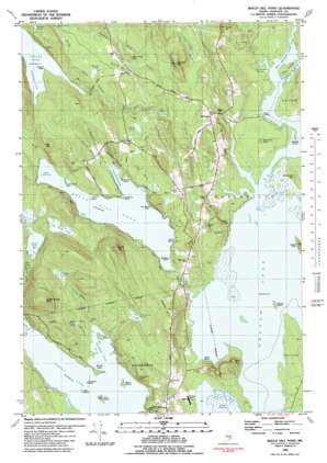
Beech Hill Pond Topo Map Maine
To zoom in, hover over the map of Beech Hill Pond
USGS Topo Quad 44068f4 - 1:24,000 scale
| Topo Map Name: | Beech Hill Pond |
| USGS Topo Quad ID: | 44068f4 |
| Print Size: | ca. 21 1/4" wide x 27" high |
| Southeast Coordinates: | 44.625° N latitude / 68.375° W longitude |
| Map Center Coordinates: | 44.6875° N latitude / 68.4375° W longitude |
| U.S. State: | ME |
| Filename: | o44068f4.jpg |
| Download Map JPG Image: | Beech Hill Pond topo map 1:24,000 scale |
| Map Type: | Topographic |
| Topo Series: | 7.5´ |
| Map Scale: | 1:24,000 |
| Source of Map Images: | United States Geological Survey (USGS) |
| Alternate Map Versions: |
Beech Hill Pond ME 1981, updated 1982 Download PDF Buy paper map Beech Hill Pond ME 1981, updated 1982 Download PDF Buy paper map Beech Hill Pond ME 2011 Download PDF Buy paper map Beech Hill Pond ME 2014 Download PDF Buy paper map |
1:24,000 Topo Quads surrounding Beech Hill Pond
> Back to 44068e1 at 1:100,000 scale
> Back to 44068a1 at 1:250,000 scale
> Back to U.S. Topo Maps home
Beech Hill Pond topo map: Gazetteer
Beech Hill Pond: Bars
Junk of Pork Rock elevation 76m 249′Two Bush Rock elevation 60m 196′
Beech Hill Pond: Bays
Deep Cove elevation 60m 196′Head of the Pond elevation 60m 196′
Northeast Cove elevation 49m 160′
Schoolhouse Cove elevation 60m 196′
Southwest Cove elevation 91m 298′
Turtle Cove elevation 60m 196′
Beech Hill Pond: Beaches
Dunn Beach elevation 60m 196′Jesse Beach elevation 32m 104′
Beech Hill Pond: Benches
Jordan Ledge elevation 75m 246′Porcupine Ledge elevation 65m 213′
Beech Hill Pond: Capes
Carlisle Point elevation 32m 104′Dodges Point elevation 60m 196′
Kimball Point elevation 93m 305′
Remick Point elevation 60m 196′
Salisbury Point elevation 61m 200′
Scotts Neck elevation 51m 167′
The Tongue elevation 33m 108′
Beech Hill Pond: Dams
Green Lake Dam elevation 48m 157′Trout Brook Flowage elevation 32m 104′
Beech Hill Pond: Islands
Black Island elevation 49m 160′Cow Island elevation 54m 177′
Deer Island elevation 49m 160′
Fish Island elevation 51m 167′
Parkhurst Island elevation 49m 160′
Beech Hill Pond: Lakes
Beech Hill Pond elevation 60m 196′Buggy Pond elevation 117m 383′
Little Burnt Pond elevation 70m 229′
Morrison Pond elevation 76m 249′
Muddy Pond elevation 88m 288′
Rile Pond elevation 64m 209′
Rocky Pond elevation 62m 203′
Wormwood Pond elevation 68m 223′
Youngs Pond elevation 78m 255′
Beech Hill Pond: Populated Places
Lakewood elevation 52m 170′Mariaville elevation 69m 226′
Otis elevation 91m 298′
Beech Hill Pond: Reservoirs
Green Lake elevation 48m 157′Keisers Pond elevation 49m 160′
Beech Hill Pond: Streams
Boggy Brook elevation 49m 160′Dumb Brook elevation 32m 104′
East Branch Union River elevation 32m 104′
Harvey Brook elevation 65m 213′
Little Dumb Brook elevation 42m 137′
Mink Brook elevation 49m 160′
Mosquito Brook elevation 71m 232′
Schoolhouse Brook elevation 63m 206′
Sucker Brook elevation 50m 164′
Tannery Brook elevation 32m 104′
Turtle Brook elevation 61m 200′
West Branch Union River elevation 32m 104′
Beech Hill Pond: Summits
Beech Hill elevation 58m 190′Burnt Hub Hill elevation 102m 334′
Great Brook Hill elevation 179m 587′
Grotto Hill elevation 165m 541′
Hardwood Hill elevation 42m 137′
Hopkins Hill elevation 126m 413′
Morrison Knoll elevation 43m 141′
Oak Hill elevation 135m 442′
Sightly Hill elevation 113m 370′
Tannery Hill elevation 101m 331′
Tinker Hill elevation 98m 321′
Beech Hill Pond digital topo map on disk
Buy this Beech Hill Pond topo map showing relief, roads, GPS coordinates and other geographical features, as a high-resolution digital map file on DVD:
Maine, New Hampshire, Rhode Island & Eastern Massachusetts
Buy digital topo maps: Maine, New Hampshire, Rhode Island & Eastern Massachusetts


