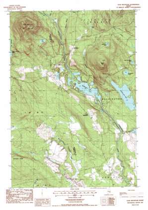
Lead Mountain Topo Map Maine
To zoom in, hover over the map of Lead Mountain
USGS Topo Quad 44068g1 - 1:24,000 scale
| Topo Map Name: | Lead Mountain |
| USGS Topo Quad ID: | 44068g1 |
| Print Size: | ca. 21 1/4" wide x 27" high |
| Southeast Coordinates: | 44.75° N latitude / 68° W longitude |
| Map Center Coordinates: | 44.8125° N latitude / 68.0625° W longitude |
| U.S. State: | ME |
| Filename: | o44068g1.jpg |
| Download Map JPG Image: | Lead Mountain topo map 1:24,000 scale |
| Map Type: | Topographic |
| Topo Series: | 7.5´ |
| Map Scale: | 1:24,000 |
| Source of Map Images: | United States Geological Survey (USGS) |
| Alternate Map Versions: |
Lead Mountain ME 1987, updated 1988 Download PDF Buy paper map Lead Mountain ME 2011 Download PDF Buy paper map Lead Mountain ME 2014 Download PDF Buy paper map |
1:24,000 Topo Quads surrounding Lead Mountain
> Back to 44068e1 at 1:100,000 scale
> Back to 44068a1 at 1:250,000 scale
> Back to U.S. Topo Maps home
Lead Mountain topo map: Gazetteer
Lead Mountain: Dams
Bog Brook Dam elevation 75m 246′Lead Mountain: Lakes
Bear Pond elevation 172m 564′Beddington Lake elevation 74m 242′
Chalk Pond elevation 78m 255′
Gray Pond elevation 153m 501′
Horseshoe Pond elevation 116m 380′
Little Horseshoe Pond elevation 130m 426′
Mountain Pond elevation 183m 600′
Spruce Mountain Lake elevation 97m 318′
Lead Mountain: Populated Places
Beddington elevation 163m 534′Lower Beddington elevation 147m 482′
Lead Mountain: Reservoirs
Bog Brook Flowage elevation 75m 246′Lead Mountain: Ridges
Smith Ridge elevation 156m 511′Lead Mountain: Streams
Bobcat Brook elevation 95m 311′Bog Brook elevation 72m 236′
Humpback Brook elevation 97m 318′
Little Narraguagus River elevation 78m 255′
Meadow Brook elevation 119m 390′
Pork Brook elevation 59m 193′
Shorey Brook elevation 77m 252′
Sinclair Brook elevation 98m 321′
Lead Mountain: Summits
Lead Mountain elevation 439m 1440′Spruce Mountain elevation 321m 1053′
Lead Mountain: Trails
Lead Mountain Trail elevation 317m 1040′Lead Mountain digital topo map on disk
Buy this Lead Mountain topo map showing relief, roads, GPS coordinates and other geographical features, as a high-resolution digital map file on DVD:
Maine, New Hampshire, Rhode Island & Eastern Massachusetts
Buy digital topo maps: Maine, New Hampshire, Rhode Island & Eastern Massachusetts


