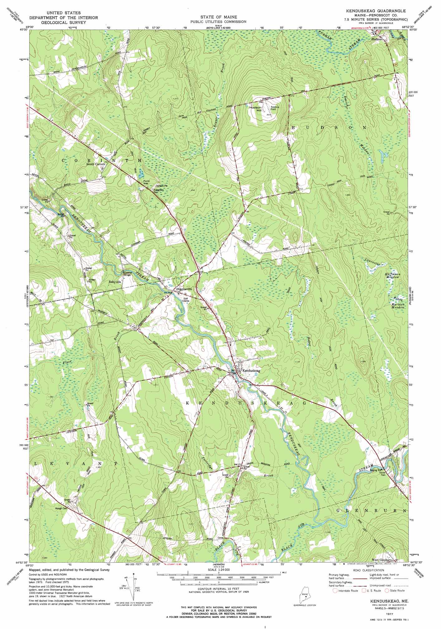
Kenduskeag Topo Map Maine
To zoom in, hover over the map of Kenduskeag
USGS Topo Quad 44068h8 - 1:24,000 scale
| Topo Map Name: | Kenduskeag |
| USGS Topo Quad ID: | 44068h8 |
| Print Size: | ca. 21 1/4" wide x 27" high |
| Southeast Coordinates: | 44.875° N latitude / 68.875° W longitude |
| Map Center Coordinates: | 44.9375° N latitude / 68.9375° W longitude |
| U.S. State: | ME |
| Filename: | o44068h8.jpg |
| Download Map JPG Image: | Kenduskeag topo map 1:24,000 scale |
| Map Type: | Topographic |
| Topo Series: | 7.5´ |
| Map Scale: | 1:24,000 |
| Source of Map Images: | United States Geological Survey (USGS) |
| Alternate Map Versions: |
Kenduskeag ME 1977, updated 1977 Download PDF Buy paper map Kenduskeag ME 1977, updated 1977 Download PDF Buy paper map Kenduskeag ME 2011 Download PDF Buy paper map Kenduskeag ME 2014 Download PDF Buy paper map |
1:24,000 Topo Quads surrounding Kenduskeag
Dover-Foxcroft |
South Sebec |
Milo South |
Lagrange |
Howland |
Garland |
Charleston |
Bradford |
South Lagrange |
Greenbush |
Stetson |
West Corinth |
Kenduskeag |
Pushaw Lake |
Old Town |
Plymouth |
Carmel |
Hermon |
Bangor |
Veazie |
Dixmont |
East Dixmont |
Snow Mountain |
Hampden |
Brewer Lake |
> Back to 44068e1 at 1:100,000 scale
> Back to 44068a1 at 1:250,000 scale
> Back to U.S. Topo Maps home
Kenduskeag topo map: Gazetteer
Kenduskeag: Airports
Robbins Field elevation 112m 367′Kenduskeag: Bridges
Robyville Bridge elevation 40m 131′Kenduskeag: Populated Places
Higginsville elevation 40m 131′Kenduskeag elevation 30m 98′
Robyville elevation 51m 167′
South Corinth elevation 89m 291′
West Glenburn elevation 93m 305′
Kenduskeag: Streams
Baker Brook elevation 31m 101′Beaver Meadow elevation 43m 141′
Black Stream elevation 30m 98′
Partridge Brook elevation 32m 104′
Piper Brook elevation 40m 131′
Kenduskeag: Summits
Hudson Hill elevation 111m 364′Kenduskeag: Swamps
Halfmoon Meadow elevation 35m 114′Kenduskeag digital topo map on disk
Buy this Kenduskeag topo map showing relief, roads, GPS coordinates and other geographical features, as a high-resolution digital map file on DVD:
Maine, New Hampshire, Rhode Island & Eastern Massachusetts
Buy digital topo maps: Maine, New Hampshire, Rhode Island & Eastern Massachusetts