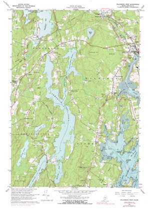
Waldoboro West Topo Map Maine
To zoom in, hover over the map of Waldoboro West
USGS Topo Quad 44069a4 - 1:24,000 scale
| Topo Map Name: | Waldoboro West |
| USGS Topo Quad ID: | 44069a4 |
| Print Size: | ca. 21 1/4" wide x 27" high |
| Southeast Coordinates: | 44° N latitude / 69.375° W longitude |
| Map Center Coordinates: | 44.0625° N latitude / 69.4375° W longitude |
| U.S. State: | ME |
| Filename: | o44069a4.jpg |
| Download Map JPG Image: | Waldoboro West topo map 1:24,000 scale |
| Map Type: | Topographic |
| Topo Series: | 7.5´ |
| Map Scale: | 1:24,000 |
| Source of Map Images: | United States Geological Survey (USGS) |
| Alternate Map Versions: |
Waldoboro West ME 1965, updated 1967 Download PDF Buy paper map Waldoboro West ME 1965, updated 1974 Download PDF Buy paper map Waldoboro West ME 1965, updated 1983 Download PDF Buy paper map Waldoboro West ME 1965, updated 1991 Download PDF Buy paper map Waldoboro West ME 1965, updated 1991 Download PDF Buy paper map Waldoboro West ME 2011 Download PDF Buy paper map Waldoboro West ME 2014 Download PDF Buy paper map |
1:24,000 Topo Quads surrounding Waldoboro West
> Back to 44069a1 at 1:100,000 scale
> Back to 44068a1 at 1:250,000 scale
> Back to U.S. Topo Maps home
Waldoboro West topo map: Gazetteer
Waldoboro West: Bars
Northeast Point Ledges elevation 0m 0′Waldoboro West: Bays
Broad Cove elevation 0m 0′Deep Cove elevation 16m 52′
Havener Cove elevation 2m 6′
Meetinghouse Cove elevation 0m 0′
Muscongus Bay elevation 16m 52′
Waldoboro West: Capes
Butter Point elevation 4m 13′East Neck elevation 33m 108′
Gross Neck elevation 22m 72′
Havener Point elevation 5m 16′
Heath Point elevation 14m 45′
Hoffse Point elevation 11m 36′
Jones Neck elevation 18m 59′
West Neck elevation 55m 180′
Woltz Point elevation 7m 22′
Waldoboro West: Channels
The Narrows elevation 0m 0′Waldoboro West: Dams
Waldoboro Dam elevation 0m 0′Waldoboro West: Islands
Hardy Island elevation 1m 3′Johnson Island elevation 8m 26′
Waldoboro West: Lakes
Biscay Pond elevation 23m 75′Duckpuddle Pond elevation 23m 75′
Gross Pond elevation 29m 95′
Kalers Pond elevation 38m 124′
Little Pond elevation 33m 108′
McCurdy Pond elevation 23m 75′
Muddy Pond elevation 35m 114′
Pemaquid Pond elevation 23m 75′
Waldoboro West: Parks
Noble Monument elevation 51m 167′Waldoboro West: Populated Places
Bremen elevation 23m 75′Broad Cove elevation 40m 131′
Eugley Corner elevation 33m 108′
Glendon elevation 38m 124′
Harrington Corner elevation 22m 72′
Kalers Corner elevation 26m 85′
Knowlton Corner elevation 52m 170′
Medomak elevation 14m 45′
Nobleboro elevation 57m 187′
Sprague Corner elevation 38m 124′
Turners Corner elevation 35m 114′
Waldoboro elevation 22m 72′
West Waldoboro elevation 55m 180′
Winslow Hill elevation 56m 183′
Winslows Mills elevation 20m 65′
Waldoboro West: Reservoirs
Medomak River Reservoir elevation 0m 0′Waldoboro West: Streams
Back Meadow Brook elevation 23m 75′Beaverdam Brook elevation 24m 78′
Eastern Branch elevation 0m 0′
Medomak River elevation 0m 0′
Western Brook elevation 0m 0′
Waldoboro West: Summits
Benner Hill elevation 87m 285′Cordwood Hill elevation 102m 334′
Johnston Hill elevation 92m 301′
Procks Ledge elevation 42m 137′
Waldoboro West digital topo map on disk
Buy this Waldoboro West topo map showing relief, roads, GPS coordinates and other geographical features, as a high-resolution digital map file on DVD:
Maine, New Hampshire, Rhode Island & Eastern Massachusetts
Buy digital topo maps: Maine, New Hampshire, Rhode Island & Eastern Massachusetts


