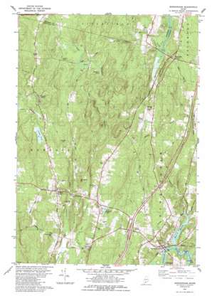
Bowdoinham Topo Map Maine
To zoom in, hover over the map of Bowdoinham
USGS Topo Quad 44069a8 - 1:24,000 scale
| Topo Map Name: | Bowdoinham |
| USGS Topo Quad ID: | 44069a8 |
| Print Size: | ca. 21 1/4" wide x 27" high |
| Southeast Coordinates: | 44° N latitude / 69.875° W longitude |
| Map Center Coordinates: | 44.0625° N latitude / 69.9375° W longitude |
| U.S. State: | ME |
| Filename: | o44069a8.jpg |
| Download Map JPG Image: | Bowdoinham topo map 1:24,000 scale |
| Map Type: | Topographic |
| Topo Series: | 7.5´ |
| Map Scale: | 1:24,000 |
| Source of Map Images: | United States Geological Survey (USGS) |
| Alternate Map Versions: |
Bowdoinham ME 1980, updated 1980 Download PDF Buy paper map Bowdoinham ME 1980, updated 1989 Download PDF Buy paper map Bowdoinham ME 2011 Download PDF Buy paper map Bowdoinham ME 2014 Download PDF Buy paper map |
1:24,000 Topo Quads surrounding Bowdoinham
> Back to 44069a1 at 1:100,000 scale
> Back to 44068a1 at 1:250,000 scale
> Back to U.S. Topo Maps home
Bowdoinham topo map: Gazetteer
Bowdoinham: Airports
Merrymeeting Field elevation 18m 59′Bowdoinham: Capes
Patten Point elevation 0m 0′Bowdoinham: Crossings
Interchange 25 elevation 51m 167′Bowdoinham: Dams
Bar B Campground Pond Dam elevation 54m 177′Bowdoinham: Lakes
Caesar Pond elevation 103m 337′Meacham Pond elevation 84m 275′
Bowdoinham: Populated Places
Bowdoin Center elevation 49m 160′Bowdoinham elevation 23m 75′
Richmond Corner elevation 77m 252′
Starbird Corner elevation 123m 403′
Varney Corner elevation 88m 288′
Bowdoinham: Reservoirs
Bar B Campground Pond elevation 61m 200′Stoddard Pond elevation 54m 177′
Bowdoinham: Ridges
Bowdoinham Ridge elevation 68m 223′Bowdoinham: Streams
Dead River elevation 86m 282′East Cathance Stream elevation 28m 91′
Magotty Meadow Brook elevation 41m 134′
Mallon Brook elevation 33m 108′
Sedgely Brook elevation 1m 3′
West Branch Denham Stream elevation 0m 0′
West Cathance Stream elevation 29m 95′
Bowdoinham: Summits
Hornbeam Hill elevation 79m 259′Wheeler Hill elevation 89m 291′
Bowdoinham digital topo map on disk
Buy this Bowdoinham topo map showing relief, roads, GPS coordinates and other geographical features, as a high-resolution digital map file on DVD:
Maine, New Hampshire, Rhode Island & Eastern Massachusetts
Buy digital topo maps: Maine, New Hampshire, Rhode Island & Eastern Massachusetts


