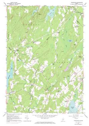
Washington Topo Map Maine
To zoom in, hover over the map of Washington
USGS Topo Quad 44069c3 - 1:24,000 scale
| Topo Map Name: | Washington |
| USGS Topo Quad ID: | 44069c3 |
| Print Size: | ca. 21 1/4" wide x 27" high |
| Southeast Coordinates: | 44.25° N latitude / 69.25° W longitude |
| Map Center Coordinates: | 44.3125° N latitude / 69.3125° W longitude |
| U.S. State: | ME |
| Filename: | o44069c3.jpg |
| Download Map JPG Image: | Washington topo map 1:24,000 scale |
| Map Type: | Topographic |
| Topo Series: | 7.5´ |
| Map Scale: | 1:24,000 |
| Source of Map Images: | United States Geological Survey (USGS) |
| Alternate Map Versions: |
Washington ME 1961, updated 1964 Download PDF Buy paper map Washington ME 1961, updated 1974 Download PDF Buy paper map Washington ME 1961, updated 1974 Download PDF Buy paper map Washington ME 2011 Download PDF Buy paper map Washington ME 2014 Download PDF Buy paper map |
1:24,000 Topo Quads surrounding Washington
> Back to 44069a1 at 1:100,000 scale
> Back to 44068a1 at 1:250,000 scale
> Back to U.S. Topo Maps home
Washington topo map: Gazetteer
Washington: Dams
Appleton Ridge Pond Dam elevation 161m 528′Pettengill Marsh Dam elevation 78m 255′
Washington Pond Dam elevation 99m 324′
Washington: Lakes
Cargill Pond elevation 181m 593′Johnson Pond elevation 148m 485′
Muddy Pond elevation 90m 295′
Newbert Pond elevation 88m 288′
The Pool elevation 90m 295′
Washington: Populated Places
Appleton elevation 49m 160′Burkettville elevation 83m 272′
Connors Corner elevation 144m 472′
Lucas Corner elevation 68m 223′
Maddocks Corner elevation 105m 344′
Martins Corner elevation 128m 419′
Morang Corner elevation 76m 249′
North Union elevation 71m 232′
Oakes Corner elevation 151m 495′
Pease Corner elevation 114m 374′
Proctors Corner elevation 108m 354′
Sawpit Corner elevation 85m 278′
South Liberty elevation 93m 305′
South Montville elevation 92m 301′
Stovers Corner elevation 109m 357′
Washington elevation 91m 298′
West Appleton elevation 97m 318′
Woodmans Mills elevation 85m 278′
Washington: Reservoirs
Appleton Ridge Pond elevation 161m 528′Pettengill Marsh elevation 78m 255′
Washington Pond elevation 99m 324′
Washington: Ridges
Appleton Ridge elevation 194m 636′Washington: Streams
Allen Brook elevation 27m 88′Dead River elevation 83m 272′
Fish Brook elevation 72m 236′
Harriet Brook elevation 84m 275′
Pettengill Stream elevation 46m 150′
Washington Brook elevation 48m 157′
Washington: Summits
Coon Mountain elevation 248m 813′Johnson Hill elevation 168m 551′
Washington: Swamps
Cedar Swamp elevation 89m 291′Washington digital topo map on disk
Buy this Washington topo map showing relief, roads, GPS coordinates and other geographical features, as a high-resolution digital map file on DVD:
Maine, New Hampshire, Rhode Island & Eastern Massachusetts
Buy digital topo maps: Maine, New Hampshire, Rhode Island & Eastern Massachusetts


