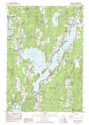
China Lake Topo Map Maine
To zoom in, hover over the map of China Lake
USGS Topo Quad 44069d5 - 1:24,000 scale
| Topo Map Name: | China Lake |
| USGS Topo Quad ID: | 44069d5 |
| Print Size: | ca. 21 1/4" wide x 27" high |
| Southeast Coordinates: | 44.375° N latitude / 69.5° W longitude |
| Map Center Coordinates: | 44.4375° N latitude / 69.5625° W longitude |
| U.S. State: | ME |
| Filename: | o44069d5.jpg |
| Download Map JPG Image: | China Lake topo map 1:24,000 scale |
| Map Type: | Topographic |
| Topo Series: | 7.5´ |
| Map Scale: | 1:24,000 |
| Source of Map Images: | United States Geological Survey (USGS) |
| Alternate Map Versions: |
Vassalboro NE ME 1975, updated 1980 Download PDF Buy paper map China Lake ME 1983, updated 1983 Download PDF Buy paper map China Lake ME 1983, updated 1983 Download PDF Buy paper map China Lake ME 2011 Download PDF Buy paper map China Lake ME 2014 Download PDF Buy paper map |
1:24,000 Topo Quads surrounding China Lake
> Back to 44069a1 at 1:100,000 scale
> Back to 44068a1 at 1:250,000 scale
> Back to U.S. Topo Maps home
China Lake topo map: Gazetteer
China Lake: Capes
Killdeer Point elevation 70m 229′Wentworth Point elevation 60m 196′
China Lake: Dams
China Lake Dam elevation 60m 196′Ladd Dam elevation 45m 147′
Lombards Dam elevation 53m 173′
Masses Dam elevation 56m 183′
Morneaus Dam elevation 53m 173′
China Lake: Islands
Indian Island elevation 60m 196′China Lake: Lakes
Evans Pond elevation 96m 314′Mud Pond elevation 71m 232′
China Lake: Populated Places
China elevation 70m 229′Dirigo Corner elevation 127m 416′
East Vassalboro elevation 58m 190′
North Vassalboro elevation 48m 157′
South China elevation 68m 223′
South Vassalboro elevation 57m 187′
China Lake: Reservoirs
China Lake elevation 60m 196′Outlet Stream elevation 56m 183′
Outlet Stream elevation 45m 147′
Outlet Stream elevation 53m 173′
Outlet Stream elevation 53m 173′
China Lake: Streams
Hunter Brook elevation 60m 196′China Lake: Summits
Priest Hill elevation 108m 354′China Lake: Swamps
Emery Swamp elevation 73m 239′China Lake digital topo map on disk
Buy this China Lake topo map showing relief, roads, GPS coordinates and other geographical features, as a high-resolution digital map file on DVD:
Maine, New Hampshire, Rhode Island & Eastern Massachusetts
Buy digital topo maps: Maine, New Hampshire, Rhode Island & Eastern Massachusetts


