Albion Topo Map Maine
To zoom in, hover over the map of Albion
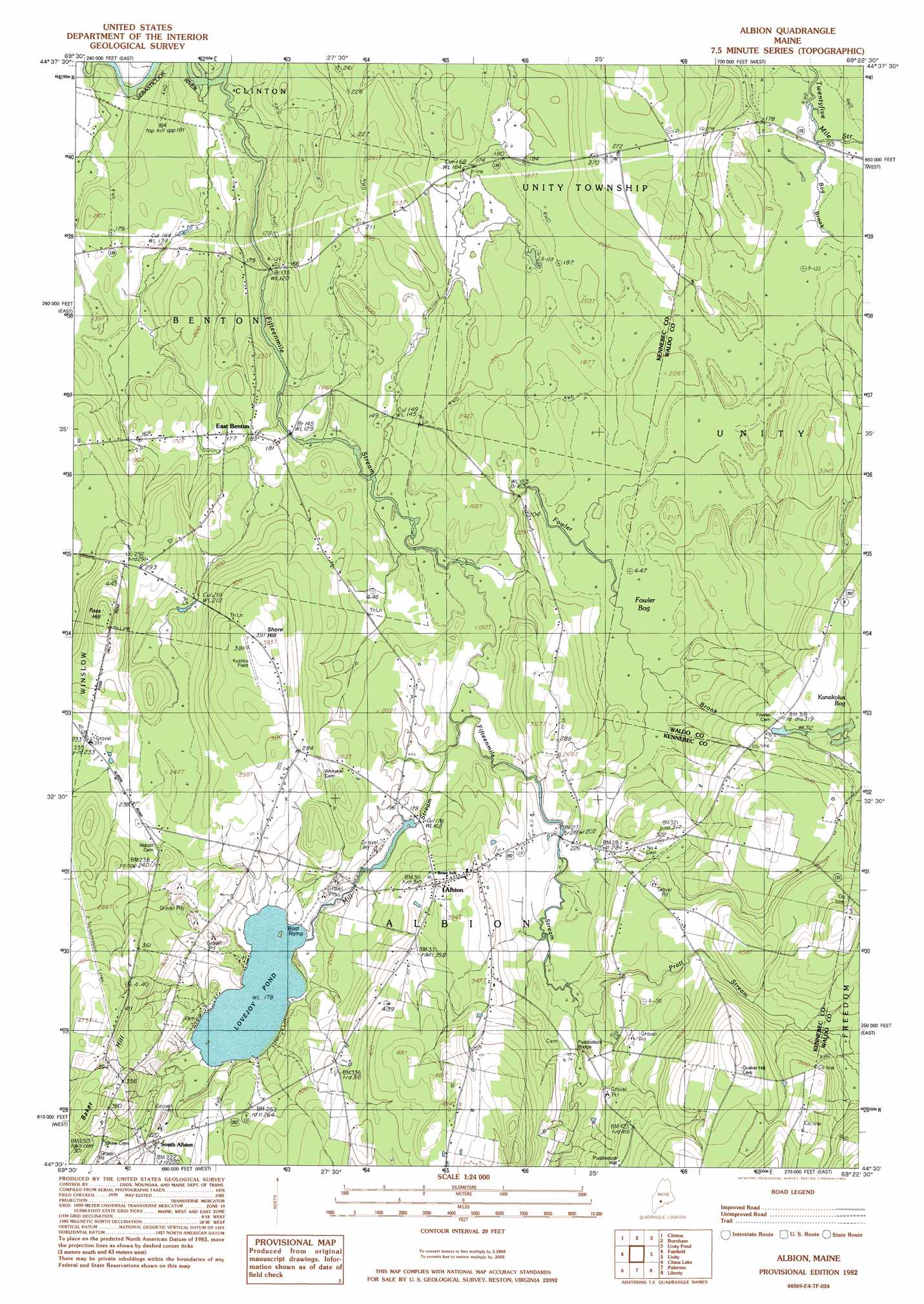
USGS Topo Quad 44069e4 - 1:24,000 scale
| Topo Map Name: | Albion |
| USGS Topo Quad ID: | 44069e4 |
| Print Size: | ca. 21 1/4" wide x 27" high |
| Southeast Coordinates: | 44.5° N latitude / 69.375° W longitude |
| Map Center Coordinates: | 44.5625° N latitude / 69.4375° W longitude |
| U.S. State: | ME |
| Filename: | o44069e4.jpg |
| Download Map JPG Image: | Albion topo map 1:24,000 scale |
| Map Type: | Topographic |
| Topo Series: | 7.5´ |
| Map Scale: | 1:24,000 |
| Source of Map Images: | United States Geological Survey (USGS) |
| Alternate Map Versions: |
Burnham SW ME 1975, updated 1980 Download PDF Buy paper map Albion ME 1982, updated 1983 Download PDF Buy paper map Albion ME 2011 Download PDF Buy paper map Albion ME 2014 Download PDF Buy paper map |
1:24,000 Topo Quads surrounding Albion
Skowhegan |
Canaan |
Pittsfield |
Newport |
Plymouth |
Hinckley |
Clinton |
Burnham |
Unity Pond |
Dixmont |
Waterville |
Fairfield |
Albion |
Unity |
Brooks West |
Vassalboro |
China Lake |
Palermo |
Liberty |
Morrill |
Togus Pond |
Weeks Mills |
Razorville |
Washington |
Searsmont |
> Back to 44069e1 at 1:100,000 scale
> Back to 44068a1 at 1:250,000 scale
> Back to U.S. Topo Maps home
Albion topo map: Gazetteer
Albion: Bridges
Gridiron Bridge elevation 37m 121′Puddledock Bridge elevation 72m 236′
Albion: Dams
Mill Stream Dam elevation 53m 173′Albion: Lakes
Lovejoy Pond elevation 54m 177′Albion: Populated Places
Albion elevation 92m 301′East Benton elevation 55m 180′
South Albion elevation 67m 219′
Albion: Reservoirs
Mill Stream elevation 56m 183′Albion: Streams
Fifteenmile Stream elevation 35m 114′Fowler Brook elevation 40m 131′
Mill Stream elevation 42m 137′
Pratt Stream elevation 72m 236′
Albion: Summits
Foss Hill elevation 131m 429′Shore Hill elevation 118m 387′
Albion: Swamps
Fowler Bog elevation 53m 173′Albion digital topo map on disk
Buy this Albion topo map showing relief, roads, GPS coordinates and other geographical features, as a high-resolution digital map file on DVD:
Maine, New Hampshire, Rhode Island & Eastern Massachusetts
Buy digital topo maps: Maine, New Hampshire, Rhode Island & Eastern Massachusetts