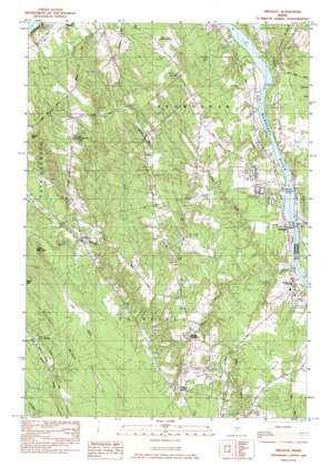
Hinckley Topo Map Maine
To zoom in, hover over the map of Hinckley
USGS Topo Quad 44069f6 - 1:24,000 scale
| Topo Map Name: | Hinckley |
| USGS Topo Quad ID: | 44069f6 |
| Print Size: | ca. 21 1/4" wide x 27" high |
| Southeast Coordinates: | 44.625° N latitude / 69.625° W longitude |
| Map Center Coordinates: | 44.6875° N latitude / 69.6875° W longitude |
| U.S. State: | ME |
| Filename: | o44069f6.jpg |
| Download Map JPG Image: | Hinckley topo map 1:24,000 scale |
| Map Type: | Topographic |
| Topo Series: | 7.5´ |
| Map Scale: | 1:24,000 |
| Source of Map Images: | United States Geological Survey (USGS) |
| Alternate Map Versions: |
Waterville NW ME 1975, updated 1980 Download PDF Buy paper map Hinckley ME 1982, updated 1982 Download PDF Buy paper map Hinckley ME 2011 Download PDF Buy paper map Hinckley ME 2014 Download PDF Buy paper map |
1:24,000 Topo Quads surrounding Hinckley
> Back to 44069e1 at 1:100,000 scale
> Back to 44068a1 at 1:250,000 scale
> Back to U.S. Topo Maps home
Hinckley topo map: Gazetteer
Hinckley: Airports
Hapworths Landing Area elevation 77m 252′Hinckley: Populated Places
Hinckley elevation 37m 121′Holway Corner elevation 76m 249′
Hoxies elevation 89m 291′
Larone elevation 64m 209′
North Fairfield elevation 53m 173′
Pishon Ferry elevation 45m 147′
Hinckley: Ridges
Brooks Ridge elevation 102m 334′Hinckley: Streams
Carrabassett Stream elevation 33m 108′Craigin Brook elevation 37m 121′
Lost Brook elevation 56m 183′
Martin Stream elevation 33m 108′
Snow Brook elevation 81m 265′
Hinckley: Summits
Bigelow Hill elevation 238m 780′Burrill Hill elevation 170m 557′
Little Bear Mountain elevation 134m 439′
Hinckley digital topo map on disk
Buy this Hinckley topo map showing relief, roads, GPS coordinates and other geographical features, as a high-resolution digital map file on DVD:
Maine, New Hampshire, Rhode Island & Eastern Massachusetts
Buy digital topo maps: Maine, New Hampshire, Rhode Island & Eastern Massachusetts


