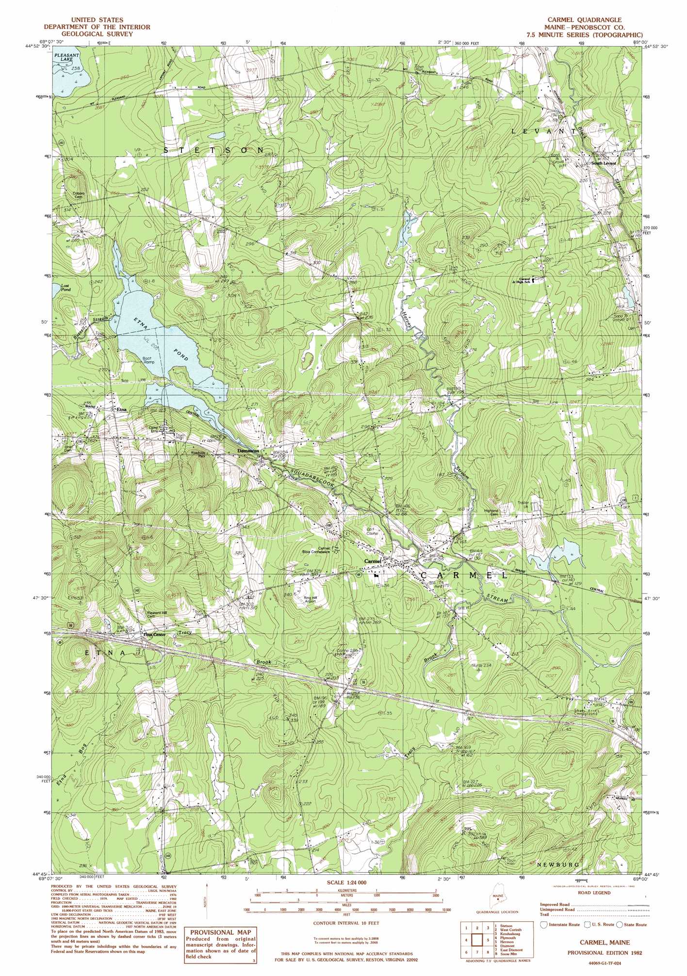
Carmel Topo Map Maine
To zoom in, hover over the map of Carmel
USGS Topo Quad 44069g1 - 1:24,000 scale
| Topo Map Name: | Carmel |
| USGS Topo Quad ID: | 44069g1 |
| Print Size: | ca. 21 1/4" wide x 27" high |
| Southeast Coordinates: | 44.75° N latitude / 69° W longitude |
| Map Center Coordinates: | 44.8125° N latitude / 69.0625° W longitude |
| U.S. State: | ME |
| Filename: | o44069g1.jpg |
| Download Map JPG Image: | Carmel topo map 1:24,000 scale |
| Map Type: | Topographic |
| Topo Series: | 7.5´ |
| Map Scale: | 1:24,000 |
| Source of Map Images: | United States Geological Survey (USGS) |
| Alternate Map Versions: |
Stetson SE ME 1976, updated 1980 Download PDF Buy paper map Carmell ME 1982, updated 1983 Download PDF Buy paper map Carmel ME 1982, updated 1983 Download PDF Buy paper map Carmel ME 2011 Download PDF Buy paper map Carmel ME 2014 Download PDF Buy paper map |
1:24,000 Topo Quads surrounding Carmel
Dexter |
Garland |
Charleston |
Bradford |
South Lagrange |
Corinna |
Stetson |
West Corinth |
Kenduskeag |
Pushaw Lake |
Newport |
Plymouth |
Carmel |
Hermon |
Bangor |
Unity Pond |
Dixmont |
East Dixmont |
Snow Mountain |
Hampden |
Unity |
Brooks West |
Brooks East |
Mount Waldo |
Bucksport |
> Back to 44069e1 at 1:100,000 scale
> Back to 44068a1 at 1:250,000 scale
> Back to U.S. Topo Maps home
Carmel topo map: Gazetteer
Carmel: Airports
Ring Hill Airport elevation 98m 321′Carmel: Crossings
Interchange 42 elevation 91m 298′Carmel: Lakes
Etna Pond elevation 62m 203′Lost Pond elevation 68m 223′
Carmel: Populated Places
Carmel elevation 53m 173′Damascus elevation 67m 219′
Etna elevation 71m 232′
Etna Center elevation 94m 308′
South Levant elevation 59m 193′
Carmel: Streams
Buzzell Stream elevation 62m 203′Harvey Stream elevation 39m 127′
Hill Brook elevation 38m 124′
Tracy Brook elevation 39m 127′
Carmel: Swamps
Etna Bog elevation 97m 318′Carmel digital topo map on disk
Buy this Carmel topo map showing relief, roads, GPS coordinates and other geographical features, as a high-resolution digital map file on DVD:
Maine, New Hampshire, Rhode Island & Eastern Massachusetts
Buy digital topo maps: Maine, New Hampshire, Rhode Island & Eastern Massachusetts