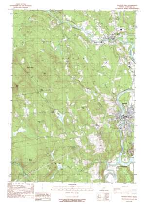
Madison West Topo Map Maine
To zoom in, hover over the map of Madison West
USGS Topo Quad 44069g8 - 1:24,000 scale
| Topo Map Name: | Madison West |
| USGS Topo Quad ID: | 44069g8 |
| Print Size: | ca. 21 1/4" wide x 27" high |
| Southeast Coordinates: | 44.75° N latitude / 69.875° W longitude |
| Map Center Coordinates: | 44.8125° N latitude / 69.9375° W longitude |
| U.S. State: | ME |
| Filename: | o44069g8.jpg |
| Download Map JPG Image: | Madison West topo map 1:24,000 scale |
| Map Type: | Topographic |
| Topo Series: | 7.5´ |
| Map Scale: | 1:24,000 |
| Source of Map Images: | United States Geological Survey (USGS) |
| Alternate Map Versions: |
Anson SW ME 1976, updated 1980 Download PDF Buy paper map Madison West ME 1989, updated 1989 Download PDF Buy paper map Madison West ME 2011 Download PDF Buy paper map Madison West ME 2014 Download PDF Buy paper map |
1:24,000 Topo Quads surrounding Madison West
> Back to 44069e1 at 1:100,000 scale
> Back to 44068a1 at 1:250,000 scale
> Back to U.S. Topo Maps home
Madison West topo map: Gazetteer
Madison West: Capes
Old Point elevation 52m 170′Madison West: Dams
Abenaquis Dam elevation 64m 209′Anson Station Dam elevation 73m 239′
Madison Paper Corporation Log Dam elevation 58m 190′
Madison West: Islands
Savage Island elevation 78m 255′Madison West: Lakes
Cold Pond elevation 97m 318′Nevens Pond elevation 114m 374′
Madison West: Populated Places
Anson elevation 73m 239′Dane Corner elevation 168m 551′
Madison elevation 92m 301′
North Anson elevation 91m 298′
Pease Corner elevation 121m 396′
Madison West: Post Offices
Anson Post Office elevation 87m 285′Madison Post Office elevation 89m 291′
Madison West: Reservoirs
Kennebec River Reservoir elevation 61m 200′Kennebec River Reservoir elevation 58m 190′
Kennebec River Reservoir elevation 67m 219′
Madison West: Streams
Carrabassett River elevation 75m 246′Fahi Brook elevation 98m 321′
Falls Brook elevation 118m 387′
Getchell Brook elevation 73m 239′
Gilbert Brook elevation 76m 249′
Gilman Brook elevation 76m 249′
Hilton Brook elevation 60m 196′
Jones Brook elevation 64m 209′
Meadow Brook elevation 102m 334′
Mill Stream elevation 98m 321′
Pelton Brook elevation 48m 157′
Sandy River elevation 47m 154′
Town Farm Brook elevation 96m 314′
Madison West: Summits
Barton Hill elevation 393m 1289′Hilton Hill elevation 202m 662′
Holland Waite Hill elevation 292m 958′
Lane Hill elevation 298m 977′
Mount Hunger elevation 214m 702′
Pease Hill elevation 235m 770′
Sterry Hill elevation 205m 672′
Madison West: Swamps
Mayhew Bog elevation 105m 344′Madison West digital topo map on disk
Buy this Madison West topo map showing relief, roads, GPS coordinates and other geographical features, as a high-resolution digital map file on DVD:
Maine, New Hampshire, Rhode Island & Eastern Massachusetts
Buy digital topo maps: Maine, New Hampshire, Rhode Island & Eastern Massachusetts


