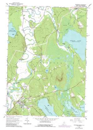
Fryeburg Topo Map Maine
To zoom in, hover over the map of Fryeburg
USGS Topo Quad 44070a8 - 1:24,000 scale
| Topo Map Name: | Fryeburg |
| USGS Topo Quad ID: | 44070a8 |
| Print Size: | ca. 21 1/4" wide x 27" high |
| Southeast Coordinates: | 44° N latitude / 70.875° W longitude |
| Map Center Coordinates: | 44.0625° N latitude / 70.9375° W longitude |
| U.S. States: | ME, NH |
| Filename: | o44070a8.jpg |
| Download Map JPG Image: | Fryeburg topo map 1:24,000 scale |
| Map Type: | Topographic |
| Topo Series: | 7.5´ |
| Map Scale: | 1:24,000 |
| Source of Map Images: | United States Geological Survey (USGS) |
| Alternate Map Versions: |
Fryeburg ME 1963, updated 1965 Download PDF Buy paper map Fryeburg ME 1963, updated 1989 Download PDF Buy paper map Fryeburg ME 2011 Download PDF Buy paper map Fryeburg ME 2014 Download PDF Buy paper map |
1:24,000 Topo Quads surrounding Fryeburg
> Back to 44070a1 at 1:100,000 scale
> Back to 44070a1 at 1:250,000 scale
> Back to U.S. Topo Maps home
Fryeburg topo map: Gazetteer
Fryeburg: Bridges
Hemlock Bridge elevation 112m 367′Fryeburg: Dams
Fryeburg Dam elevation 122m 400′Kezar River Mill Dam elevation 121m 396′
Swans Falls Dam elevation 116m 380′
Fryeburg: Falls
Swans Falls elevation 117m 383′Fryeburg: Islands
Loon Island elevation 109m 357′Loon Island elevation 117m 383′
Walker Island elevation 111m 364′
Fryeburg: Lakes
Bog Pond elevation 113m 370′Cat Pond elevation 110m 360′
Dead Lake elevation 112m 367′
Horseshoe Pond elevation 112m 367′
Horseshoe Pond elevation 116m 380′
Hunt Pond elevation 145m 475′
Kezar Pond elevation 112m 367′
Lovewell Pond elevation 109m 357′
Lower Kimball Pond elevation 116m 380′
Pleasant Pond elevation 110m 360′
Fryeburg: Parks
Bradley Memorial Park elevation 129m 423′Main Street Historic District elevation 131m 429′
Fryeburg: Populated Places
Fryeburg elevation 131m 429′Fryeburg Center elevation 134m 439′
Highland Park elevation 180m 590′
North Fryeburg elevation 116m 380′
West Fryeburg elevation 122m 400′
Fryeburg: Reservoirs
Mill Pond elevation 110m 360′Saco River Reservoir elevation 116m 380′
Wards Pond elevation 122m 400′
Fryeburg: Streams
Black Brook elevation 110m 360′Fight Brook elevation 109m 357′
Kezar River elevation 112m 367′
Kimball Brook elevation 116m 380′
Popple Hill Brook elevation 115m 377′
Prays Brook elevation 114m 374′
Weeks Brook elevation 116m 380′
Weeks Brook elevation 118m 387′
White Lot Brook elevation 120m 393′
Fryeburg: Summits
Birch Hill elevation 234m 767′Jockey Cap elevation 179m 587′
Mount Tom elevation 317m 1040′
Oak Hill elevation 207m 679′
Smarts Hill elevation 197m 646′
Stanley Hill elevation 195m 639′
Starks Mountain elevation 313m 1026′
Fryeburg: Swamps
Swimming Bog elevation 114m 374′Fryeburg digital topo map on disk
Buy this Fryeburg topo map showing relief, roads, GPS coordinates and other geographical features, as a high-resolution digital map file on DVD:
Maine, New Hampshire, Rhode Island & Eastern Massachusetts
Buy digital topo maps: Maine, New Hampshire, Rhode Island & Eastern Massachusetts


