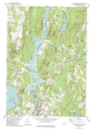
Lake Auburn East Topo Map Maine
To zoom in, hover over the map of Lake Auburn East
USGS Topo Quad 44070b2 - 1:24,000 scale
| Topo Map Name: | Lake Auburn East |
| USGS Topo Quad ID: | 44070b2 |
| Print Size: | ca. 21 1/4" wide x 27" high |
| Southeast Coordinates: | 44.125° N latitude / 70.125° W longitude |
| Map Center Coordinates: | 44.1875° N latitude / 70.1875° W longitude |
| U.S. State: | ME |
| Filename: | o44070b2.jpg |
| Download Map JPG Image: | Lake Auburn East topo map 1:24,000 scale |
| Map Type: | Topographic |
| Topo Series: | 7.5´ |
| Map Scale: | 1:24,000 |
| Source of Map Images: | United States Geological Survey (USGS) |
| Alternate Map Versions: |
Lake Auburn East ME 1979, updated 1979 Download PDF Buy paper map Lake Auburn East ME 2011 Download PDF Buy paper map Lake Auburn East ME 2014 Download PDF Buy paper map |
1:24,000 Topo Quads surrounding Lake Auburn East
> Back to 44070a1 at 1:100,000 scale
> Back to 44070a1 at 1:250,000 scale
> Back to U.S. Topo Maps home
Lake Auburn East topo map: Gazetteer
Lake Auburn East: Airports
Twitchell Airport elevation 108m 354′Lake Auburn East: Beaches
Auburn Municipal Beach elevation 79m 259′Lake Auburn East: Dams
Deer Rips Dam elevation 52m 170′Gulf Island Dam elevation 63m 206′
Lake Auburn Dam elevation 75m 246′
Lake Auburn East: Lakes
Allen Pond elevation 103m 337′Berry Pond elevation 131m 429′
Daggett Bog elevation 93m 305′
Deane Pond elevation 133m 436′
Lard Pond elevation 102m 334′
Little Sabattus Pond elevation 80m 262′
Round Pond elevation 99m 324′
Lake Auburn East: Parks
Tot Lot elevation 101m 331′Lake Auburn East: Populated Places
Auburn Plains elevation 100m 328′East Auburn elevation 81m 265′
Foggs Corner elevation 102m 334′
Greene elevation 95m 311′
Greene Corner elevation 98m 321′
South Turner elevation 162m 531′
Lake Auburn East: Reservoirs
Androscoggin River Reservoir elevation 63m 206′Gulf Island Pond elevation 63m 206′
Lake Auburn elevation 75m 246′
Lake Auburn East: Ridges
Hill Ridge elevation 212m 695′Lake Auburn East: Springs
Glenrock Spring elevation 80m 262′Lake Auburn East: Streams
Bradford Brook elevation 80m 262′Stetson Brook elevation 58m 190′
Lake Auburn East: Summits
Clark Mountain elevation 208m 682′Merrill Hill elevation 204m 669′
Mount Giles elevation 166m 544′
Poplar Hill elevation 205m 672′
Lake Auburn East digital topo map on disk
Buy this Lake Auburn East topo map showing relief, roads, GPS coordinates and other geographical features, as a high-resolution digital map file on DVD:
Maine, New Hampshire, Rhode Island & Eastern Massachusetts
Buy digital topo maps: Maine, New Hampshire, Rhode Island & Eastern Massachusetts


