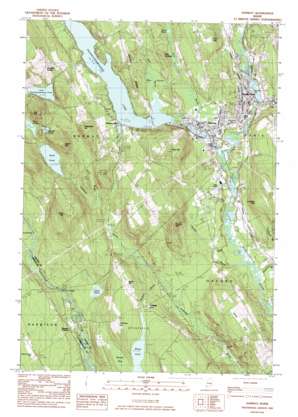
Norway Topo Map Maine
To zoom in, hover over the map of Norway
USGS Topo Quad 44070b5 - 1:24,000 scale
| Topo Map Name: | Norway |
| USGS Topo Quad ID: | 44070b5 |
| Print Size: | ca. 21 1/4" wide x 27" high |
| Southeast Coordinates: | 44.125° N latitude / 70.5° W longitude |
| Map Center Coordinates: | 44.1875° N latitude / 70.5625° W longitude |
| U.S. State: | ME |
| Filename: | o44070b5.jpg |
| Download Map JPG Image: | Norway topo map 1:24,000 scale |
| Map Type: | Topographic |
| Topo Series: | 7.5´ |
| Map Scale: | 1:24,000 |
| Source of Map Images: | United States Geological Survey (USGS) |
| Alternate Map Versions: |
Norway ME 1983, updated 1983 Download PDF Buy paper map Norway ME 2000, updated 2001 Download PDF Buy paper map Norway ME 2011 Download PDF Buy paper map Norway ME 2014 Download PDF Buy paper map |
1:24,000 Topo Quads surrounding Norway
> Back to 44070a1 at 1:100,000 scale
> Back to 44070a1 at 1:250,000 scale
> Back to U.S. Topo Maps home
Norway topo map: Gazetteer
Norway: Dams
Little Pennesseewassee Pond Dam elevation 166m 544′Pennesseewassee Lake Dam elevation 116m 380′
Sand Pond Dam elevation 153m 501′
South Paris Dam elevation 102m 334′
Norway: Falls
Steep Falls elevation 116m 380′Norway: Lakes
Bird Pond elevation 131m 429′Little Pond elevation 133m 436′
Moose Pond elevation 160m 524′
Round Pond elevation 187m 613′
Norway: Parks
McLaughlin Garden elevation 121m 396′Norway Historic District elevation 117m 383′
Norway: Populated Places
Norway elevation 118m 387′Norway Center elevation 179m 587′
Norway Lake elevation 128m 419′
Otisfield Gore elevation 159m 521′
South Paris elevation 118m 387′
Stuarts Corner elevation 123m 403′
Norway: Post Offices
South Paris Post Office elevation 117m 383′Norway: Reservoirs
Little Androscoggin River Reservoir elevation 102m 334′Little Pennesseewassee Pond elevation 166m 544′
Pennesseewassee Lake elevation 116m 380′
Sand Pond elevation 153m 501′
Norway: Ridges
Crooked Ridge elevation 153m 501′Norway: Streams
Bird Brook elevation 112m 367′Bogg Brook elevation 121m 396′
Lombard Brook elevation 110m 360′
Pennesseewassee Stream elevation 99m 324′
Sargent Brook elevation 110m 360′
Stony Brook elevation 106m 347′
Town Farm Brook elevation 95m 311′
Webber Brook elevation 95m 311′
Norway: Summits
Allen Hill elevation 198m 649′Andrews Hill elevation 217m 711′
Brett Hill elevation 205m 672′
Elm Hill elevation 204m 669′
Frost Hill elevation 277m 908′
Hathaway Hill elevation 169m 554′
Horse Hill elevation 255m 836′
Isaiah Hill elevation 253m 830′
Jim Hill elevation 243m 797′
Lovejoy Hill elevation 199m 652′
Pike Hill elevation 249m 816′
The Nubble elevation 163m 534′
Norway: Swamps
Bearce Bog elevation 160m 524′Witt Swamp elevation 122m 400′
Norway digital topo map on disk
Buy this Norway topo map showing relief, roads, GPS coordinates and other geographical features, as a high-resolution digital map file on DVD:
Maine, New Hampshire, Rhode Island & Eastern Massachusetts
Buy digital topo maps: Maine, New Hampshire, Rhode Island & Eastern Massachusetts


