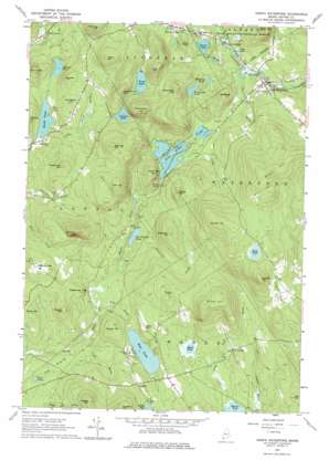
North Waterford Topo Map Maine
To zoom in, hover over the map of North Waterford
USGS Topo Quad 44070b7 - 1:24,000 scale
| Topo Map Name: | North Waterford |
| USGS Topo Quad ID: | 44070b7 |
| Print Size: | ca. 21 1/4" wide x 27" high |
| Southeast Coordinates: | 44.125° N latitude / 70.75° W longitude |
| Map Center Coordinates: | 44.1875° N latitude / 70.8125° W longitude |
| U.S. State: | ME |
| Filename: | o44070b7.jpg |
| Download Map JPG Image: | North Waterford topo map 1:24,000 scale |
| Map Type: | Topographic |
| Topo Series: | 7.5´ |
| Map Scale: | 1:24,000 |
| Source of Map Images: | United States Geological Survey (USGS) |
| Alternate Map Versions: |
North Waterford ME 1963, updated 1964 Download PDF Buy paper map North Waterford ME 1963, updated 1976 Download PDF Buy paper map North Waterford ME 1995, updated 2000 Download PDF Buy paper map North Waterford ME 2012 Download PDF Buy paper map North Waterford ME 2014 Download PDF Buy paper map |
| FStopo: | US Forest Service topo North Waterford is available: Download FStopo PDF Download FStopo TIF |
1:24,000 Topo Quads surrounding North Waterford
> Back to 44070a1 at 1:100,000 scale
> Back to 44070a1 at 1:250,000 scale
> Back to U.S. Topo Maps home
North Waterford topo map: Gazetteer
North Waterford: Dams
Cushman Pond Dam elevation 217m 711′Heald Pond Dam elevation 144m 472′
North Waterford: Falls
Kezar Falls elevation 185m 606′North Waterford: Lakes
Black Pond elevation 148m 485′Bradley Pond elevation 155m 508′
Dan Charles Pond elevation 144m 472′
Duck Pond elevation 326m 1069′
Five Kezar Ponds elevation 174m 570′
Keyes Pond elevation 155m 508′
Lily Pond elevation 129m 423′
Mud Pond elevation 170m 557′
Proctor Pond elevation 176m 577′
Trout Pond elevation 242m 793′
Weymouth Pond elevation 217m 711′
Whitney Pond elevation 180m 590′
North Waterford: Populated Places
East Sweden elevation 164m 538′Lynchville elevation 170m 557′
North Waterford elevation 190m 623′
Slab City elevation 157m 515′
Sweden elevation 212m 695′
North Waterford: Reservoirs
Cushman Pond elevation 217m 711′Heald Pond elevation 144m 472′
North Waterford: Streams
Cold Brook elevation 126m 413′Duck Pond Brook elevation 134m 439′
Green Brook elevation 175m 574′
Keyes Brook elevation 127m 416′
Little Trout Brook elevation 143m 469′
Mill Brook elevation 165m 541′
Patterson Brook elevation 134m 439′
Powers Brook elevation 135m 442′
Warren Brook elevation 167m 547′
North Waterford: Summits
Allen Mountain elevation 360m 1181′Amos Mountain elevation 287m 941′
Baldpate elevation 289m 948′
Beech Hill elevation 467m 1532′
Burnell Hill elevation 424m 1391′
Clough Hill elevation 214m 702′
Eastman Hill elevation 251m 823′
Edgecomb Hill elevation 206m 675′
Evans Hill elevation 281m 921′
Flat Hill elevation 268m 879′
Foster Hill elevation 226m 741′
Foster Hill elevation 343m 1125′
Harding Hill elevation 332m 1089′
Howard Mountain elevation 255m 836′
Kenniston Hill elevation 239m 784′
Kezar Falls Hill elevation 273m 895′
Marr Hill elevation 287m 941′
McDaniels Hill elevation 358m 1174′
McDaniels Hill elevation 276m 905′
Oak Hill elevation 362m 1187′
Patterson Hill elevation 286m 938′
Perry Hill elevation 208m 682′
Pine Hill elevation 233m 764′
Popple Hill elevation 355m 1164′
Sabattus Mountain elevation 379m 1243′
Skillings Hill elevation 344m 1128′
Stearns Hill elevation 414m 1358′
Stone Hill elevation 298m 977′
Weymouth Hill elevation 349m 1145′
Whitehouse Hill elevation 331m 1085′
Whiting Hill elevation 243m 797′
Winns Hill elevation 374m 1227′
North Waterford: Valleys
Kezar Falls Gorge elevation 155m 508′North Waterford digital topo map on disk
Buy this North Waterford topo map showing relief, roads, GPS coordinates and other geographical features, as a high-resolution digital map file on DVD:
Maine, New Hampshire, Rhode Island & Eastern Massachusetts
Buy digital topo maps: Maine, New Hampshire, Rhode Island & Eastern Massachusetts


