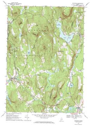
Buckfield Topo Map Maine
To zoom in, hover over the map of Buckfield
USGS Topo Quad 44070c3 - 1:24,000 scale
| Topo Map Name: | Buckfield |
| USGS Topo Quad ID: | 44070c3 |
| Print Size: | ca. 21 1/4" wide x 27" high |
| Southeast Coordinates: | 44.25° N latitude / 70.25° W longitude |
| Map Center Coordinates: | 44.3125° N latitude / 70.3125° W longitude |
| U.S. State: | ME |
| Filename: | o44070c3.jpg |
| Download Map JPG Image: | Buckfield topo map 1:24,000 scale |
| Map Type: | Topographic |
| Topo Series: | 7.5´ |
| Map Scale: | 1:24,000 |
| Source of Map Images: | United States Geological Survey (USGS) |
| Alternate Map Versions: |
Buckfield ME 1967, updated 1969 Download PDF Buy paper map Buckfield ME 1967, updated 1969 Download PDF Buy paper map Buckfield ME 2011 Download PDF Buy paper map Buckfield ME 2014 Download PDF Buy paper map |
1:24,000 Topo Quads surrounding Buckfield
> Back to 44070a1 at 1:100,000 scale
> Back to 44070a1 at 1:250,000 scale
> Back to U.S. Topo Maps home
Buckfield topo map: Gazetteer
Buckfield: Airports
Cooper Seaplane Base elevation 114m 374′Buckfield: Dams
Brush Shop Dam elevation 101m 331′Old Mill Bulkhead Dam elevation 113m 370′
Turner Dam elevation 92m 301′
Buckfield: Lakes
Crystal Pond elevation 100m 328′Little Bear Pond elevation 114m 374′
Northeast Pond elevation 130m 426′
Pickerel Pond elevation 102m 334′
South Pond elevation 110m 360′
Swan Pond elevation 175m 574′
Buckfield: Populated Places
Buckfield elevation 109m 357′Chase Mills elevation 100m 328′
East Buckfield elevation 142m 465′
Hartford elevation 139m 456′
North Turner elevation 118m 387′
Turner elevation 97m 318′
Buckfield: Reservoirs
Bear Pond elevation 113m 370′Nezinscot River Reservoir elevation 92m 301′
West Branch Nezinscot River Reservoir elevation 100m 328′
Buckfield: Springs
Mount Oxford Spring elevation 146m 479′Buckfield: Streams
Blanchard Stream elevation 103m 337′Bog Brook elevation 94m 308′
Bunganock Brook elevation 118m 387′
Drew Brook elevation 103m 337′
East Branch Nezinscot River elevation 93m 305′
Hayford Brook elevation 114m 374′
Lively Brook elevation 100m 328′
Martin Stream elevation 93m 305′
Meadow Brook elevation 88m 288′
Mitchell Brook elevation 176m 577′
Swan Pond Brook elevation 93m 305′
West Branch Nezinscot River elevation 93m 305′
Buckfield: Summits
Bear Mountain elevation 357m 1171′Cary Hill elevation 226m 741′
Deacon Pinnacle elevation 230m 754′
General Turner Hill elevation 196m 643′
Hayford Hill elevation 346m 1135′
Hutchinson Hill elevation 340m 1115′
Irish Hill elevation 316m 1036′
Irish Hill elevation 186m 610′
Mount Oxford elevation 254m 833′
North Hill elevation 208m 682′
Ricker Hill elevation 196m 643′
Robinson Hill elevation 254m 833′
Russell Hill elevation 301m 987′
Teague Hill elevation 249m 816′
The Pinnacle elevation 114m 374′
Buckfield: Swamps
Jersey Bog elevation 103m 337′Buckfield digital topo map on disk
Buy this Buckfield topo map showing relief, roads, GPS coordinates and other geographical features, as a high-resolution digital map file on DVD:
Maine, New Hampshire, Rhode Island & Eastern Massachusetts
Buy digital topo maps: Maine, New Hampshire, Rhode Island & Eastern Massachusetts


