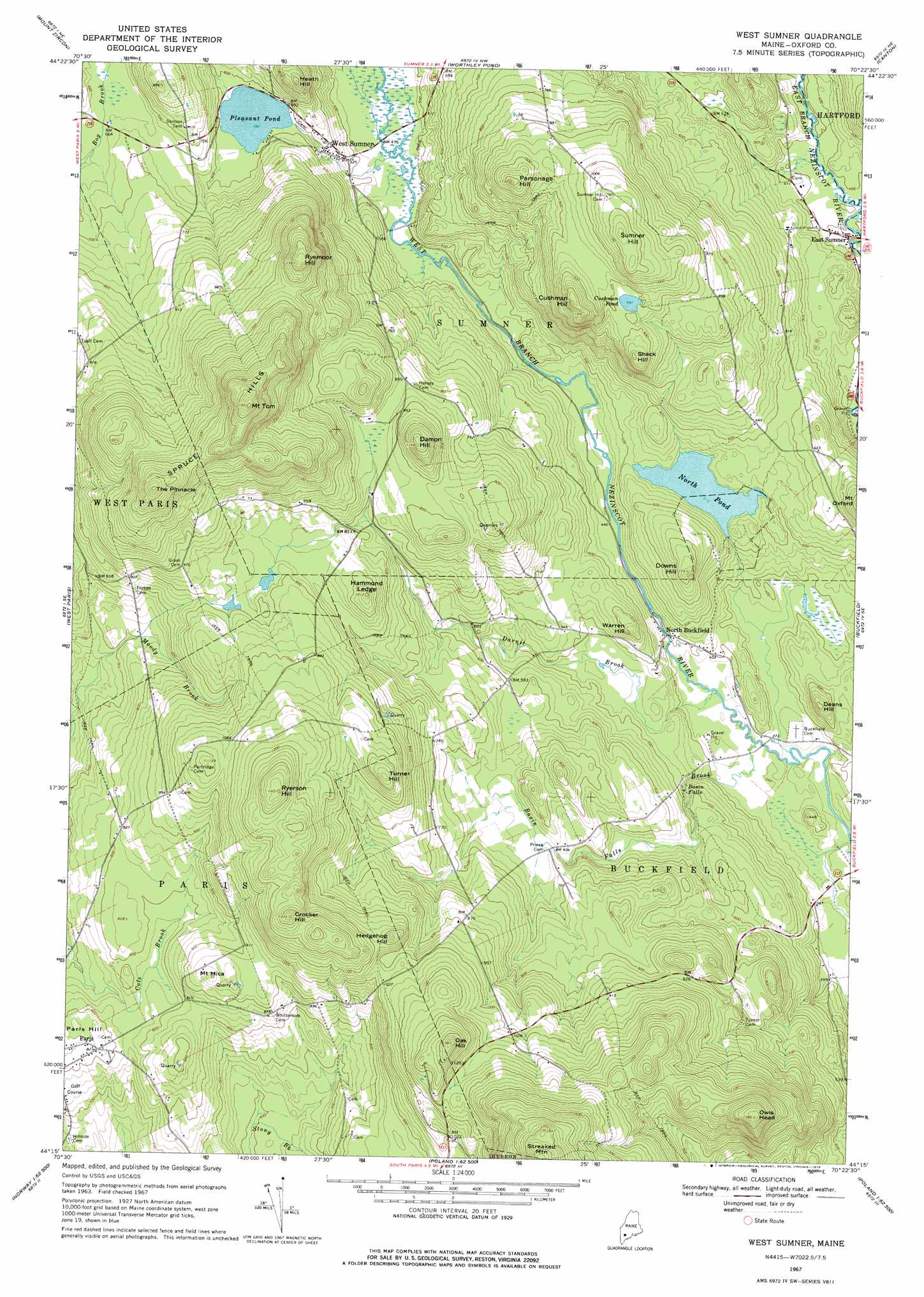
West Sumner Topo Map Maine
To zoom in, hover over the map of West Sumner
USGS Topo Quad 44070c4 - 1:24,000 scale
| Topo Map Name: | West Sumner |
| USGS Topo Quad ID: | 44070c4 |
| Print Size: | ca. 21 1/4" wide x 27" high |
| Southeast Coordinates: | 44.25° N latitude / 70.375° W longitude |
| Map Center Coordinates: | 44.3125° N latitude / 70.4375° W longitude |
| U.S. State: | ME |
| Filename: | o44070c4.jpg |
| Download Map JPG Image: | West Sumner topo map 1:24,000 scale |
| Map Type: | Topographic |
| Topo Series: | 7.5´ |
| Map Scale: | 1:24,000 |
| Source of Map Images: | United States Geological Survey (USGS) |
| Alternate Map Versions: |
West Sumner ME 1967, updated 1969 Download PDF Buy paper map West Sumner ME 1967, updated 1976 Download PDF Buy paper map West Sumner ME 2011 Download PDF Buy paper map West Sumner ME 2014 Download PDF Buy paper map |
1:24,000 Topo Quads surrounding West Sumner
East Andover |
Rumford |
Dixfield |
East Dixfield |
Wilton |
Bryant Pond |
Mount Zircon |
Worthley Pond |
Canton |
Livermore Falls |
Greenwood |
West Paris |
West Sumner |
Buckfield |
Turner Center |
Ralph |
Norway |
Oxford |
Lake Auburn West |
Lake Auburn East |
Bridgton |
Casco |
Mechanic Falls |
Minot |
Lewiston |
> Back to 44070a1 at 1:100,000 scale
> Back to 44070a1 at 1:250,000 scale
> Back to U.S. Topo Maps home
West Sumner topo map: Gazetteer
West Sumner: Airports
Cummings Airport elevation 279m 915′West Sumner: Dams
North Pond Dam elevation 147m 482′West Sumner: Falls
Basin Falls elevation 127m 416′West Sumner: Lakes
Cushman Pond elevation 271m 889′Pleasant Pond elevation 177m 580′
West Sumner: Parks
Paris Hills Historic District elevation 235m 770′West Sumner: Populated Places
East Sumner elevation 122m 400′North Buckfield elevation 122m 400′
West Sumner elevation 165m 541′
West Sumner: Reservoirs
North Pond elevation 147m 482′West Sumner: Streams
Basin Falls Brook elevation 110m 360′Darnit Brook elevation 111m 364′
West Sumner: Summits
Crocker Hill elevation 415m 1361′Cushman Hill elevation 336m 1102′
Damon Hill elevation 342m 1122′
Deans Hill elevation 185m 606′
Downs Hill elevation 233m 764′
Hammond Ledge elevation 293m 961′
Heath Hill elevation 272m 892′
Hedgehog Hill elevation 349m 1145′
Mount Mica elevation 305m 1000′
Mount Tom elevation 519m 1702′
Oak Hill elevation 416m 1364′
Owls Head elevation 422m 1384′
Paris Hill elevation 250m 820′
Parsonage Hill elevation 336m 1102′
Ryemoor Hill elevation 412m 1351′
Ryerson Hill elevation 425m 1394′
Shack Hill elevation 304m 997′
Spruce Hills elevation 475m 1558′
Sumner Hill elevation 351m 1151′
The Pinnacle elevation 459m 1505′
Turner Hill elevation 361m 1184′
Warren Hill elevation 204m 669′
West Sumner digital topo map on disk
Buy this West Sumner topo map showing relief, roads, GPS coordinates and other geographical features, as a high-resolution digital map file on DVD:
Maine, New Hampshire, Rhode Island & Eastern Massachusetts
Buy digital topo maps: Maine, New Hampshire, Rhode Island & Eastern Massachusetts