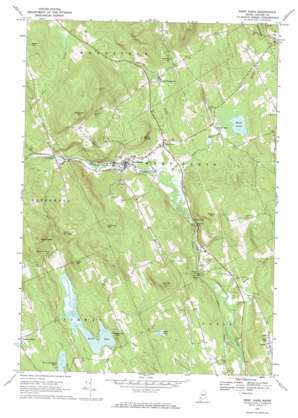
West Paris Topo Map Maine
To zoom in, hover over the map of West Paris
USGS Topo Quad 44070c5 - 1:24,000 scale
| Topo Map Name: | West Paris |
| USGS Topo Quad ID: | 44070c5 |
| Print Size: | ca. 21 1/4" wide x 27" high |
| Southeast Coordinates: | 44.25° N latitude / 70.5° W longitude |
| Map Center Coordinates: | 44.3125° N latitude / 70.5625° W longitude |
| U.S. State: | ME |
| Filename: | o44070c5.jpg |
| Download Map JPG Image: | West Paris topo map 1:24,000 scale |
| Map Type: | Topographic |
| Topo Series: | 7.5´ |
| Map Scale: | 1:24,000 |
| Source of Map Images: | United States Geological Survey (USGS) |
| Alternate Map Versions: |
West Paris ME 1967, updated 1969 Download PDF Buy paper map West Paris ME 2011 Download PDF Buy paper map West Paris ME 2014 Download PDF Buy paper map |
1:24,000 Topo Quads surrounding West Paris
> Back to 44070a1 at 1:100,000 scale
> Back to 44070a1 at 1:250,000 scale
> Back to U.S. Topo Maps home
West Paris topo map: Gazetteer
West Paris: Cliffs
Berry Ledge elevation 232m 761′Shaw Ledge elevation 302m 990′
West Paris: Dams
North Pond Dam elevation 146m 479′West Paris Dam elevation 141m 462′
West Paris: Falls
Bisco Falls elevation 115m 377′West Paris: Lakes
Moose Pond elevation 161m 528′Paine Pond elevation 177m 580′
West Paris: Parks
Courthouse Square elevation 250m 820′West Paris: Populated Places
Nobles Corner elevation 148m 485′North Paris elevation 165m 541′
Paris elevation 247m 810′
South Woodstock elevation 184m 603′
Trap Corner elevation 146m 479′
West Paris elevation 151m 495′
West Paris: Reservoirs
Little Androscoggin River Reservoir elevation 141m 462′North Pond elevation 146m 479′
West Paris: Streams
Andrews Brook elevation 139m 456′Bog Brook elevation 161m 528′
Cole Brook elevation 109m 357′
Moody Brook elevation 113m 370′
Moose Pond Brook elevation 136m 446′
Twitchell Brook elevation 152m 498′
West Paris: Summits
Cobble Hill elevation 349m 1145′Curtis Hill elevation 443m 1453′
Eastman Hill elevation 399m 1309′
Fuller Hill elevation 360m 1181′
Hedgehog Hill elevation 211m 692′
Rock Dundee elevation 319m 1046′
Stearns Hill elevation 307m 1007′
Whitman Mountain elevation 429m 1407′
Witt Hill elevation 307m 1007′
West Paris: Valleys
Snow Falls Gorge elevation 136m 446′West Paris digital topo map on disk
Buy this West Paris topo map showing relief, roads, GPS coordinates and other geographical features, as a high-resolution digital map file on DVD:
Maine, New Hampshire, Rhode Island & Eastern Massachusetts
Buy digital topo maps: Maine, New Hampshire, Rhode Island & Eastern Massachusetts


