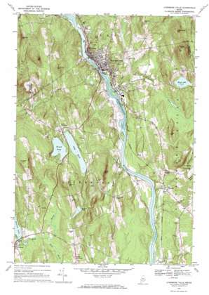
Livermore Falls Topo Map Maine
To zoom in, hover over the map of Livermore Falls
USGS Topo Quad 44070d2 - 1:24,000 scale
| Topo Map Name: | Livermore Falls |
| USGS Topo Quad ID: | 44070d2 |
| Print Size: | ca. 21 1/4" wide x 27" high |
| Southeast Coordinates: | 44.375° N latitude / 70.125° W longitude |
| Map Center Coordinates: | 44.4375° N latitude / 70.1875° W longitude |
| U.S. State: | ME |
| Filename: | o44070d2.jpg |
| Download Map JPG Image: | Livermore Falls topo map 1:24,000 scale |
| Map Type: | Topographic |
| Topo Series: | 7.5´ |
| Map Scale: | 1:24,000 |
| Source of Map Images: | United States Geological Survey (USGS) |
| Alternate Map Versions: |
Livermore Falls ME 1967, updated 1970 Download PDF Buy paper map Livermore Falls ME 1967, updated 1970 Download PDF Buy paper map Livermore Falls ME 2011 Download PDF Buy paper map Livermore Falls ME 2014 Download PDF Buy paper map |
1:24,000 Topo Quads surrounding Livermore Falls
> Back to 44070a1 at 1:100,000 scale
> Back to 44070a1 at 1:250,000 scale
> Back to U.S. Topo Maps home
Livermore Falls topo map: Gazetteer
Livermore Falls: Airports
Bowman Field elevation 100m 328′Long Pond Seaplane Base elevation 144m 472′
Livermore Falls: Dams
Brettuns Pond Dam elevation 120m 393′Livermore Falls Dam elevation 94m 308′
Otis Dam elevation 101m 331′
Livermore Falls: Lakes
Bartlett Pond elevation 150m 492′Long Pond elevation 144m 472′
Moose Hill Pond elevation 142m 465′
Round Pond elevation 144m 472′
Livermore Falls: Parks
Chisholm Square elevation 113m 370′Livermore Falls: Populated Places
Chisholm elevation 120m 393′East Livermore elevation 102m 334′
Haines Corner elevation 128m 419′
Livermore elevation 125m 410′
Livermore Center elevation 150m 492′
Livermore Falls elevation 124m 406′
North Livermore elevation 158m 518′
Shy Corner elevation 93m 305′
Livermore Falls: Reservoirs
Androscoggin River Reservoir elevation 94m 308′Androscoggin River Reservoir elevation 101m 331′
Brettuns Pond elevation 120m 393′
Livermore Falls: Streams
Beals Brook elevation 125m 410′Billington Brook elevation 95m 311′
Clay Brook elevation 85m 278′
Fish Meadow Brook elevation 85m 278′
Ford Brook elevation 120m 393′
Hunton Brook elevation 82m 269′
Meadow Brook elevation 94m 308′
Mosquito Brook elevation 105m 344′
Redwater Brook elevation 94m 308′
Scott Brook elevation 82m 269′
Livermore Falls: Summits
Chase Hill elevation 176m 577′Cow Hill elevation 322m 1056′
Ford Hill elevation 199m 652′
Hackett Hill elevation 282m 925′
Jug Hill elevation 226m 741′
Little Moose Hill elevation 233m 764′
Moose Hill elevation 339m 1112′
Oak Hill elevation 217m 711′
Philbrick Hill elevation 296m 971′
Richs Mountain elevation 235m 770′
Treat Hill elevation 185m 606′
Warren Hill elevation 206m 675′
Whitney Hill elevation 272m 892′
Livermore Falls digital topo map on disk
Buy this Livermore Falls topo map showing relief, roads, GPS coordinates and other geographical features, as a high-resolution digital map file on DVD:
Maine, New Hampshire, Rhode Island & Eastern Massachusetts
Buy digital topo maps: Maine, New Hampshire, Rhode Island & Eastern Massachusetts


