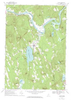
Canton Topo Map Maine
To zoom in, hover over the map of Canton
USGS Topo Quad 44070d3 - 1:24,000 scale
| Topo Map Name: | Canton |
| USGS Topo Quad ID: | 44070d3 |
| Print Size: | ca. 21 1/4" wide x 27" high |
| Southeast Coordinates: | 44.375° N latitude / 70.25° W longitude |
| Map Center Coordinates: | 44.4375° N latitude / 70.3125° W longitude |
| U.S. State: | ME |
| Filename: | o44070d3.jpg |
| Download Map JPG Image: | Canton topo map 1:24,000 scale |
| Map Type: | Topographic |
| Topo Series: | 7.5´ |
| Map Scale: | 1:24,000 |
| Source of Map Images: | United States Geological Survey (USGS) |
| Alternate Map Versions: |
Canton ME 1967, updated 1969 Download PDF Buy paper map Canton ME 1967, updated 1984 Download PDF Buy paper map Canton ME 2011 Download PDF Buy paper map Canton ME 2014 Download PDF Buy paper map |
1:24,000 Topo Quads surrounding Canton
> Back to 44070a1 at 1:100,000 scale
> Back to 44070a1 at 1:250,000 scale
> Back to U.S. Topo Maps home
Canton topo map: Gazetteer
Canton: Airports
Brettuns Pond Seaplane Base elevation 124m 406′Canton: Dams
Lake Anasagunticook Dam elevation 122m 400′Canton: Islands
Stevens Island elevation 114m 374′Canton: Lakes
Bunganock Pond elevation 142m 465′Forest Pond elevation 133m 436′
Lake Anasagunticook elevation 122m 400′
Nelson Pond elevation 234m 767′
Canton: Populated Places
Canton elevation 121m 396′Canton Point elevation 116m 380′
Gilbertville elevation 119m 390′
Meadowview elevation 116m 380′
Canton: Reservoirs
Lake Anasagunticook elevation 122m 400′Canton: Streams
Bog Brook elevation 116m 380′Childs Brook elevation 118m 387′
Fuller Brook elevation 113m 370′
Leavitt Brook elevation 123m 403′
Ludden Brook elevation 115m 377′
Sparrow Brook elevation 122m 400′
Thompson Brook elevation 123m 403′
Whitney Brook elevation 114m 374′
Worthley Brook elevation 117m 383′
Canton: Summits
Academy Hill elevation 281m 921′Allen Hill elevation 390m 1279′
Bartlett Hill elevation 253m 830′
Campbell Hill elevation 334m 1095′
Doten Hill elevation 278m 912′
Dunn Ledge elevation 216m 708′
Fish Hill elevation 342m 1122′
Hamlin Hill elevation 281m 921′
Holmes Hill elevation 281m 921′
Jewett Hill elevation 277m 908′
Little Bear Mountain elevation 334m 1095′
McCollister Hill elevation 275m 902′
Shackley Hill elevation 341m 1118′
Staples Hill elevation 245m 803′
The Pinnacle elevation 174m 570′
Thompson Hill elevation 308m 1010′
Thorne Mountain elevation 411m 1348′
Trask Mountain elevation 527m 1729′
Canton digital topo map on disk
Buy this Canton topo map showing relief, roads, GPS coordinates and other geographical features, as a high-resolution digital map file on DVD:
Maine, New Hampshire, Rhode Island & Eastern Massachusetts
Buy digital topo maps: Maine, New Hampshire, Rhode Island & Eastern Massachusetts


