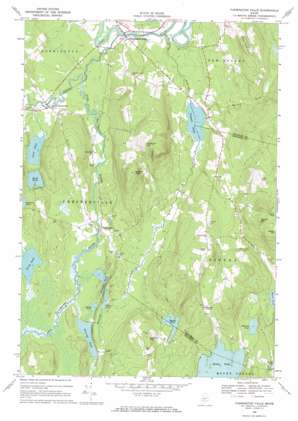
Farmington Falls Topo Map Maine
To zoom in, hover over the map of Farmington Falls
USGS Topo Quad 44070e1 - 1:24,000 scale
| Topo Map Name: | Farmington Falls |
| USGS Topo Quad ID: | 44070e1 |
| Print Size: | ca. 21 1/4" wide x 27" high |
| Southeast Coordinates: | 44.5° N latitude / 70° W longitude |
| Map Center Coordinates: | 44.5625° N latitude / 70.0625° W longitude |
| U.S. State: | ME |
| Filename: | o44070e1.jpg |
| Download Map JPG Image: | Farmington Falls topo map 1:24,000 scale |
| Map Type: | Topographic |
| Topo Series: | 7.5´ |
| Map Scale: | 1:24,000 |
| Source of Map Images: | United States Geological Survey (USGS) |
| Alternate Map Versions: |
Farmington Falls ME 1968, updated 1971 Download PDF Buy paper map Farmington Falls ME 2011 Download PDF Buy paper map Farmington Falls ME 2014 Download PDF Buy paper map |
1:24,000 Topo Quads surrounding Farmington Falls
> Back to 44070e1 at 1:100,000 scale
> Back to 44070a1 at 1:250,000 scale
> Back to U.S. Topo Maps home
Farmington Falls topo map: Gazetteer
Farmington Falls: Dams
Mercer Dam elevation 107m 351′Farmington Falls: Lakes
Black Pond elevation 107m 351′Crowell Pond elevation 99m 324′
Egypt Pond elevation 148m 485′
Fellows Pond elevation 106m 347′
Horseshoe Pond elevation 110m 360′
Locke Pond elevation 105m 344′
Norcross Pond elevation 110m 360′
North Pond elevation 110m 360′
Round Pond elevation 110m 360′
Sand Pond elevation 110m 360′
Whittier Pond elevation 110m 360′
Farmington Falls: Parks
Chesterville Wildlife Management Area elevation 116m 380′Farmington Falls: Populated Places
Chesterville elevation 116m 380′Farmington Falls elevation 105m 344′
North Chesterville elevation 108m 354′
Seaveys Corner elevation 187m 613′
Farmington Falls: Reservoirs
Little Norridgewock Stream Reservoir elevation 107m 351′Farmington Falls: Streams
Little Norridgewock Stream elevation 101m 331′McGurdy Stream elevation 97m 318′
Sugar Brook elevation 111m 364′
Whittier Brook elevation 103m 337′
Wilson Stream elevation 97m 318′
Farmington Falls: Summits
Blabon Hill elevation 276m 905′Cape Cod Hill elevation 272m 892′
Eaton Mountain elevation 305m 1000′
Old Bluff Hill elevation 294m 964′
Sanborn Hill elevation 227m 744′
Vienna Mountain elevation 313m 1026′
York Hill elevation 277m 908′
Zion Hill elevation 209m 685′
Farmington Falls digital topo map on disk
Buy this Farmington Falls topo map showing relief, roads, GPS coordinates and other geographical features, as a high-resolution digital map file on DVD:
Maine, New Hampshire, Rhode Island & Eastern Massachusetts
Buy digital topo maps: Maine, New Hampshire, Rhode Island & Eastern Massachusetts


