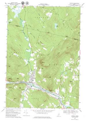
Dixfield Topo Map Maine
To zoom in, hover over the map of Dixfield
USGS Topo Quad 44070e4 - 1:24,000 scale
| Topo Map Name: | Dixfield |
| USGS Topo Quad ID: | 44070e4 |
| Print Size: | ca. 21 1/4" wide x 27" high |
| Southeast Coordinates: | 44.5° N latitude / 70.375° W longitude |
| Map Center Coordinates: | 44.5625° N latitude / 70.4375° W longitude |
| U.S. State: | ME |
| Filename: | o44070e4.jpg |
| Download Map JPG Image: | Dixfield topo map 1:24,000 scale |
| Map Type: | Topographic |
| Topo Series: | 7.5´ |
| Map Scale: | 1:24,000 |
| Source of Map Images: | United States Geological Survey (USGS) |
| Alternate Map Versions: |
Dixfield ME 1968, updated 1971 Download PDF Buy paper map Dixfield ME 1968, updated 1980 Download PDF Buy paper map Dixfield ME 2011 Download PDF Buy paper map Dixfield ME 2014 Download PDF Buy paper map |
1:24,000 Topo Quads surrounding Dixfield
> Back to 44070e1 at 1:100,000 scale
> Back to 44070a1 at 1:250,000 scale
> Back to U.S. Topo Maps home
Dixfield topo map: Gazetteer
Dixfield: Airports
Swans Field elevation 123m 403′Dixfield: Cliffs
Pauls Bluff elevation 299m 980′Whittemore Bluff elevation 212m 695′
Dixfield: Falls
The Falls elevation 133m 436′Dixfield: Flats
Siberia Meadows elevation 238m 780′Dixfield: Islands
Burke Island elevation 125m 410′Green Island elevation 120m 393′
Dixfield: Lakes
Podunk Pond elevation 269m 882′Dixfield: Pillars
Bull Rock elevation 308m 1010′Dixfield: Populated Places
Carthage elevation 140m 459′Dixfield elevation 133m 436′
Dixfield Center elevation 246m 807′
Peru elevation 124m 406′
West Peru elevation 131m 429′
Dixfield: Ridges
Harlow Ridge elevation 238m 780′Dixfield: Streams
Aunt Hannah Brook elevation 131m 429′Beaver Pond Brook elevation 133m 436′
Chase Brook elevation 131m 429′
Durgin Brook elevation 146m 479′
Edmunds Bog Brook elevation 152m 498′
Gordon Brook elevation 181m 593′
Hanscom Brook elevation 134m 439′
Harvey Brook elevation 122m 400′
Kittredge Brook elevation 134m 439′
Lower Stony Brook elevation 118m 387′
Mitchell Brook elevation 131m 429′
Moore Brook elevation 159m 521′
Newton Brook elevation 116m 380′
Paddy Meadow Brook elevation 131m 429′
Spears Stream elevation 118m 387′
Staples Brook elevation 131m 429′
Upper Stony Brook elevation 116m 380′
Webb River elevation 118m 387′
Dixfield: Summits
Burgess Hill elevation 423m 1387′Grays Mountain elevation 403m 1322′
Holman Mountain elevation 495m 1624′
Kidder Mountain elevation 270m 885′
Lovejoy Mountain elevation 296m 971′
Masterman Hill elevation 240m 787′
Morrill Ledges elevation 361m 1184′
Newton Hill elevation 288m 944′
Potter Hill elevation 268m 879′
Red Hill elevation 287m 941′
Storer Hill elevation 286m 938′
Sugarloaf elevation 444m 1456′
Trask Ledge elevation 385m 1263′
Dixfield digital topo map on disk
Buy this Dixfield topo map showing relief, roads, GPS coordinates and other geographical features, as a high-resolution digital map file on DVD:
Maine, New Hampshire, Rhode Island & Eastern Massachusetts
Buy digital topo maps: Maine, New Hampshire, Rhode Island & Eastern Massachusetts


