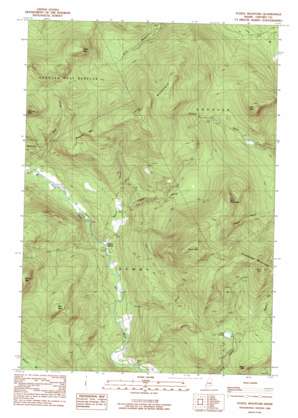
Puzzle Mountain Topo Map Maine
To zoom in, hover over the map of Puzzle Mountain
USGS Topo Quad 44070e7 - 1:24,000 scale
| Topo Map Name: | Puzzle Mountain |
| USGS Topo Quad ID: | 44070e7 |
| Print Size: | ca. 21 1/4" wide x 27" high |
| Southeast Coordinates: | 44.5° N latitude / 70.75° W longitude |
| Map Center Coordinates: | 44.5625° N latitude / 70.8125° W longitude |
| U.S. State: | ME |
| Filename: | o44070e7.jpg |
| Download Map JPG Image: | Puzzle Mountain topo map 1:24,000 scale |
| Map Type: | Topographic |
| Topo Series: | 7.5´ |
| Map Scale: | 1:24,000 |
| Source of Map Images: | United States Geological Survey (USGS) |
| Alternate Map Versions: |
Puzzle Mountain ME 1977, updated 1983 Download PDF Buy paper map Puzzle Mountain ME 1984, updated 1985 Download PDF Buy paper map Puzzle Mountain ME 2011 Download PDF Buy paper map Puzzle Mountain ME 2014 Download PDF Buy paper map |
1:24,000 Topo Quads surrounding Puzzle Mountain
> Back to 44070e1 at 1:100,000 scale
> Back to 44070a1 at 1:250,000 scale
> Back to U.S. Topo Maps home
Puzzle Mountain topo map: Gazetteer
Puzzle Mountain: Benches
Lightning Ledge elevation 732m 2401′Puzzle Mountain: Lakes
Jims Pond elevation 392m 1286′Puzzle Mountain: Parks
Step Falls Preserve elevation 264m 866′Puzzle Mountain: Populated Places
North Newry elevation 229m 751′Puzzle Mountain: Post Offices
North Newry Post Office elevation 226m 741′Puzzle Mountain: Streams
Branch Brook elevation 219m 718′Chase Hill Brook elevation 266m 872′
Great Brook elevation 212m 695′
Wight Brook elevation 260m 853′
Puzzle Mountain: Summits
Bald Mountain elevation 633m 2076′Bean Mountain elevation 495m 1624′
Black Mountain elevation 830m 2723′
Dresser Mountain elevation 618m 2027′
Little Puzzle Mountain elevation 782m 2565′
Lone Mountain elevation 609m 1998′
Long Mountain elevation 918m 3011′
Plumbago Mountain elevation 813m 2667′
Puzzle Mountain elevation 953m 3126′
Puzzle Mountain digital topo map on disk
Buy this Puzzle Mountain topo map showing relief, roads, GPS coordinates and other geographical features, as a high-resolution digital map file on DVD:
Maine, New Hampshire, Rhode Island & Eastern Massachusetts
Buy digital topo maps: Maine, New Hampshire, Rhode Island & Eastern Massachusetts


