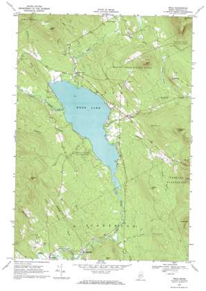
Weld Topo Map Maine
To zoom in, hover over the map of Weld
USGS Topo Quad 44070f4 - 1:24,000 scale
| Topo Map Name: | Weld |
| USGS Topo Quad ID: | 44070f4 |
| Print Size: | ca. 21 1/4" wide x 27" high |
| Southeast Coordinates: | 44.625° N latitude / 70.375° W longitude |
| Map Center Coordinates: | 44.6875° N latitude / 70.4375° W longitude |
| U.S. State: | ME |
| Filename: | o44070f4.jpg |
| Download Map JPG Image: | Weld topo map 1:24,000 scale |
| Map Type: | Topographic |
| Topo Series: | 7.5´ |
| Map Scale: | 1:24,000 |
| Source of Map Images: | United States Geological Survey (USGS) |
| Alternate Map Versions: |
Weld ME 1968, updated 1970 Download PDF Buy paper map Weld ME 1968, updated 1970 Download PDF Buy paper map Weld ME 1968, updated 1971 Download PDF Buy paper map Weld ME 2011 Download PDF Buy paper map Weld ME 2014 Download PDF Buy paper map |
1:24,000 Topo Quads surrounding Weld
> Back to 44070e1 at 1:100,000 scale
> Back to 44070a1 at 1:250,000 scale
> Back to U.S. Topo Maps home
Weld topo map: Gazetteer
Weld: Lakes
Webb Lake elevation 206m 675′Weld: Parks
Mount Blue State Park elevation 370m 1213′Weld: Populated Places
Berry Mills elevation 153m 501′Chase Corner elevation 273m 895′
Weld elevation 231m 757′
Weld Corner elevation 221m 725′
Weld: Ridges
Rand Ridge elevation 310m 1017′Weld: Streams
Bachelor Brook elevation 207m 679′Basin Brook elevation 168m 551′
Berry Brook elevation 179m 587′
Bowley Brook elevation 206m 675′
Dunning Brook elevation 144m 472′
East Brook elevation 206m 675′
Fran Brook elevation 313m 1026′
Green Brook elevation 180m 590′
Houghton Brook elevation 206m 675′
Hutchinson Brook elevation 134m 439′
Keyes Brook elevation 267m 875′
Lapham Brook elevation 156m 511′
Parlin Brook elevation 206m 675′
Rand Brook elevation 228m 748′
Snowman Brook elevation 207m 679′
Swett Brook elevation 208m 682′
West Brook elevation 207m 679′
Yeaton Brook elevation 269m 882′
Weld: Summits
Center Hill elevation 491m 1610′Cherry Hill elevation 552m 1811′
Cobble Hill elevation 494m 1620′
Green Hill elevation 348m 1141′
Hedgehog Hill elevation 416m 1364′
Holt Hill elevation 395m 1295′
Houghton Ledges elevation 514m 1686′
Hurricane Mountain elevation 755m 2477′
Lakin Hill elevation 502m 1646′
Potter Hill elevation 515m 1689′
York Hill elevation 439m 1440′
Weld digital topo map on disk
Buy this Weld topo map showing relief, roads, GPS coordinates and other geographical features, as a high-resolution digital map file on DVD:
Maine, New Hampshire, Rhode Island & Eastern Massachusetts
Buy digital topo maps: Maine, New Hampshire, Rhode Island & Eastern Massachusetts


