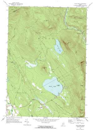
Ellis Pond Topo Map Maine
To zoom in, hover over the map of Ellis Pond
USGS Topo Quad 44070f6 - 1:24,000 scale
| Topo Map Name: | Ellis Pond |
| USGS Topo Quad ID: | 44070f6 |
| Print Size: | ca. 21 1/4" wide x 27" high |
| Southeast Coordinates: | 44.625° N latitude / 70.625° W longitude |
| Map Center Coordinates: | 44.6875° N latitude / 70.6875° W longitude |
| U.S. State: | ME |
| Filename: | o44070f6.jpg |
| Download Map JPG Image: | Ellis Pond topo map 1:24,000 scale |
| Map Type: | Topographic |
| Topo Series: | 7.5´ |
| Map Scale: | 1:24,000 |
| Source of Map Images: | United States Geological Survey (USGS) |
| Alternate Map Versions: |
Ellis Pond ME 1968, updated 1972 Download PDF Buy paper map Ellis Pond ME 1968, updated 1972 Download PDF Buy paper map Ellis Pond ME 2011 Download PDF Buy paper map Ellis Pond ME 2014 Download PDF Buy paper map |
1:24,000 Topo Quads surrounding Ellis Pond
> Back to 44070e1 at 1:100,000 scale
> Back to 44070a1 at 1:250,000 scale
> Back to U.S. Topo Maps home
Ellis Pond topo map: Gazetteer
Ellis Pond: Falls
Ellis Falls elevation 229m 751′Silver Ripple Cascade elevation 269m 882′
Ellis Pond: Gaps
Mine Notch elevation 481m 1578′Roxbury Notch elevation 386m 1266′
Ellis Pond: Islands
French Island elevation 250m 820′Ellis Pond: Lakes
Ellis Pond elevation 247m 810′Little Ellis Pond elevation 346m 1135′
Ellis Pond: Populated Places
Byron elevation 271m 889′Coos Canyon elevation 264m 866′
Ellis Pond: Streams
Beaver Brook elevation 261m 856′Black Brook elevation 218m 715′
Bog Brook elevation 210m 688′
East Branch Swift River elevation 294m 964′
Garland Brook elevation 247m 810′
Horseshoe Brook elevation 207m 679′
Meadow Brook elevation 230m 754′
Phelps Brook elevation 346m 1135′
Sawyer Brook elevation 205m 672′
West Fork Beaver Brook elevation 348m 1141′
York Brook elevation 264m 866′
Ellis Pond: Summits
Dunham Hill elevation 580m 1902′Flathead Mountain elevation 654m 2145′
Hedgehog Hill elevation 395m 1295′
Old Turk Mountain elevation 735m 2411′
Partridge Peak elevation 601m 1971′
Pleasant Mountain elevation 708m 2322′
Record Hill elevation 737m 2417′
Ellis Pond: Swamps
Santiago Bog elevation 230m 754′Ellis Pond digital topo map on disk
Buy this Ellis Pond topo map showing relief, roads, GPS coordinates and other geographical features, as a high-resolution digital map file on DVD:
Maine, New Hampshire, Rhode Island & Eastern Massachusetts
Buy digital topo maps: Maine, New Hampshire, Rhode Island & Eastern Massachusetts


