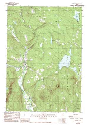
Strong Topo Map Maine
To zoom in, hover over the map of Strong
USGS Topo Quad 44070g2 - 1:24,000 scale
| Topo Map Name: | Strong |
| USGS Topo Quad ID: | 44070g2 |
| Print Size: | ca. 21 1/4" wide x 27" high |
| Southeast Coordinates: | 44.75° N latitude / 70.125° W longitude |
| Map Center Coordinates: | 44.8125° N latitude / 70.1875° W longitude |
| U.S. State: | ME |
| Filename: | o44070g2.jpg |
| Download Map JPG Image: | Strong topo map 1:24,000 scale |
| Map Type: | Topographic |
| Topo Series: | 7.5´ |
| Map Scale: | 1:24,000 |
| Source of Map Images: | United States Geological Survey (USGS) |
| Alternate Map Versions: |
Strong ME 1977, updated 1983 Download PDF Buy paper map Strong ME 1989, updated 1989 Download PDF Buy paper map Strong ME 2011 Download PDF Buy paper map Strong ME 2014 Download PDF Buy paper map |
1:24,000 Topo Quads surrounding Strong
> Back to 44070e1 at 1:100,000 scale
> Back to 44070a1 at 1:250,000 scale
> Back to U.S. Topo Maps home
Strong topo map: Gazetteer
Strong: Basins
Hartwell Intervale elevation 169m 554′Strong: Dams
Porter Lake Dam elevation 194m 636′Strong: Lakes
Day Mountain Pond elevation 419m 1374′Gammon Pond elevation 181m 593′
Lily Pond elevation 187m 613′
Mill Pond elevation 185m 606′
Nash Pond elevation 146m 479′
Taylor Hill Pond elevation 203m 666′
Strong: Populated Places
South Strong elevation 134m 439′Strong elevation 155m 508′
Strong: Reservoirs
Porter Lake elevation 194m 636′Strong: Streams
Bean Brook elevation 148m 485′Dead Stream elevation 194m 636′
Doctor Brook elevation 155m 508′
Gilkey Brook elevation 177m 580′
McLeary Brook elevation 118m 387′
Valley Brook elevation 136m 446′
Strong: Summits
Allen Pinnacle elevation 398m 1305′Dyer Hill elevation 287m 941′
Hartwell Mountain elevation 442m 1450′
Hunter Mountain elevation 440m 1443′
Leavitt Hill elevation 289m 948′
Pratt Mountain elevation 473m 1551′
Stubbs Mountain elevation 461m 1512′
Taylor Hill elevation 288m 944′
True Hill elevation 291m 954′
Strong digital topo map on disk
Buy this Strong topo map showing relief, roads, GPS coordinates and other geographical features, as a high-resolution digital map file on DVD:
Maine, New Hampshire, Rhode Island & Eastern Massachusetts
Buy digital topo maps: Maine, New Hampshire, Rhode Island & Eastern Massachusetts


