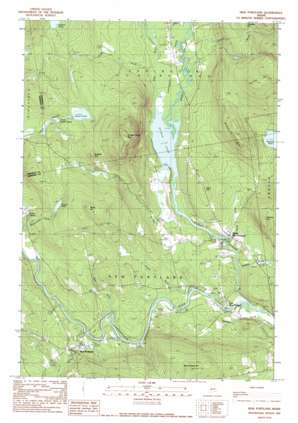
New Portland Topo Map Maine
To zoom in, hover over the map of New Portland
USGS Topo Quad 44070h1 - 1:24,000 scale
| Topo Map Name: | New Portland |
| USGS Topo Quad ID: | 44070h1 |
| Print Size: | ca. 21 1/4" wide x 27" high |
| Southeast Coordinates: | 44.875° N latitude / 70° W longitude |
| Map Center Coordinates: | 44.9375° N latitude / 70.0625° W longitude |
| U.S. State: | ME |
| Filename: | o44070h1.jpg |
| Download Map JPG Image: | New Portland topo map 1:24,000 scale |
| Map Type: | Topographic |
| Topo Series: | 7.5´ |
| Map Scale: | 1:24,000 |
| Source of Map Images: | United States Geological Survey (USGS) |
| Alternate Map Versions: |
New Portland ME 1979, updated 1983 Download PDF Buy paper map New Portland ME 1989, updated 1989 Download PDF Buy paper map New Portland ME 2011 Download PDF Buy paper map New Portland ME 2014 Download PDF Buy paper map |
1:24,000 Topo Quads surrounding New Portland
> Back to 44070e1 at 1:100,000 scale
> Back to 44070a1 at 1:250,000 scale
> Back to U.S. Topo Maps home
New Portland topo map: Gazetteer
New Portland: Airports
Hogans Field elevation 133m 436′New Portland: Bridges
New Portland Wire Bridge elevation 151m 495′New Portland: Dams
Dirigo Dowel Dam elevation 147m 482′Gilman Stream Dam elevation 112m 367′
Pennell Pond Dam elevation 240m 787′
New Portland: Flats
Lexington Flats elevation 120m 393′New Portland: Lakes
Gilman Pond elevation 113m 370′Indian Pond elevation 214m 702′
Little Indian Pond elevation 211m 692′
Safford Pond elevation 252m 826′
New Portland: Populated Places
East New Portland elevation 122m 400′Lexington elevation 126m 413′
New Portland elevation 159m 521′
North New Portland elevation 126m 413′
New Portland: Reservoirs
Gilman Stream Reservoir elevation 112m 367′Lemon Stream elevation 153m 501′
Pennell Pond elevation 240m 787′
New Portland: Streams
Alder Brook elevation 113m 370′Bloodsucker Brook elevation 158m 518′
Clarks Brook elevation 113m 370′
Dyer Brook elevation 134m 439′
Gilman Stream elevation 109m 357′
Harris Brook elevation 109m 357′
Healey Brook elevation 115m 377′
Indian Stream elevation 156m 511′
Lemon Stream elevation 140m 459′
Little Alder Brook elevation 121m 396′
Meadow Brook elevation 115m 377′
Newell Brook elevation 113m 370′
Sandy Stream elevation 113m 370′
Sucker Brook elevation 114m 374′
New Portland: Summits
Berry Hill elevation 204m 669′Brackett Hill elevation 298m 977′
Chandler Hill elevation 315m 1033′
Fletcher Hill elevation 267m 875′
Gilman Pond Mountain elevation 424m 1391′
Goodrich Hill elevation 320m 1049′
Hackett Hill elevation 397m 1302′
Millay Hill elevation 338m 1108′
New Portland Hill elevation 337m 1105′
New Portland digital topo map on disk
Buy this New Portland topo map showing relief, roads, GPS coordinates and other geographical features, as a high-resolution digital map file on DVD:
Maine, New Hampshire, Rhode Island & Eastern Massachusetts
Buy digital topo maps: Maine, New Hampshire, Rhode Island & Eastern Massachusetts


