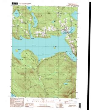
Rangeley Topo Map Maine
To zoom in, hover over the map of Rangeley
USGS Topo Quad 44070h6 - 1:24,000 scale
| Topo Map Name: | Rangeley |
| USGS Topo Quad ID: | 44070h6 |
| Print Size: | ca. 21 1/4" wide x 27" high |
| Southeast Coordinates: | 44.875° N latitude / 70.625° W longitude |
| Map Center Coordinates: | 44.9375° N latitude / 70.6875° W longitude |
| U.S. State: | ME |
| Filename: | o44070h6.jpg |
| Download Map JPG Image: | Rangeley topo map 1:24,000 scale |
| Map Type: | Topographic |
| Topo Series: | 7.5´ |
| Map Scale: | 1:24,000 |
| Source of Map Images: | United States Geological Survey (USGS) |
| Alternate Map Versions: |
Rangeley ME 1977, updated 1983 Download PDF Buy paper map Rangeley ME 1984, updated 1985 Download PDF Buy paper map Rangeley ME 1997, updated 1999 Download PDF Buy paper map Rangeley ME 2011 Download PDF Buy paper map Rangeley ME 2014 Download PDF Buy paper map |
1:24,000 Topo Quads surrounding Rangeley
> Back to 44070e1 at 1:100,000 scale
> Back to 44070a1 at 1:250,000 scale
> Back to U.S. Topo Maps home
Rangeley topo map: Gazetteer
Rangeley: Airports
Rangeley Lake Seaplane Base elevation 463m 1519′Rangeley Municipal Airport elevation 556m 1824′
Rangeley: Bays
City Cove elevation 463m 1519′Greenvale Cove elevation 463m 1519′
Hunter Cove elevation 463m 1519′
Smith Cove elevation 463m 1519′
South Cove elevation 463m 1519′
Rangeley: Capes
Bonney Point elevation 467m 1532′Haines Point elevation 463m 1519′
Rangeley: Dams
Dodge Pond Dam elevation 465m 1525′Haley Pond Dam elevation 466m 1528′
Rangeley: Islands
Doctors Island elevation 471m 1545′South Bog Islands elevation 467m 1532′
Rangeley: Lakes
Gull Pond elevation 485m 1591′Mountain Pond elevation 722m 2368′
Mud Pond elevation 741m 2431′
Quimby Pond elevation 513m 1683′
Ross Pond elevation 486m 1594′
Round Pond elevation 471m 1545′
Rangeley: Parks
Hunter Cove Wildlife Sanctuary elevation 475m 1558′Rangeley: Populated Places
Mingo Springs elevation 466m 1528′Rangeley elevation 469m 1538′
Rangeley: Post Offices
Rangeley Post Office elevation 469m 1538′Rangeley: Reservoirs
Dodge Pond elevation 465m 1525′Haley Pond elevation 466m 1528′
Rangeley: Streams
Hatchery Brook elevation 464m 1522′Martin Brook elevation 521m 1709′
Mountain Pond Stream elevation 550m 1804′
Nile Brook elevation 463m 1519′
Quimby Brook elevation 465m 1525′
South Bog Stream elevation 463m 1519′
Rangeley: Summits
Beaver Mountain elevation 955m 3133′Burnham Hill elevation 567m 1860′
Chick Hill elevation 586m 1922′
Rangeley: Swamps
South Bog elevation 463m 1519′Rangeley digital topo map on disk
Buy this Rangeley topo map showing relief, roads, GPS coordinates and other geographical features, as a high-resolution digital map file on DVD:
Maine, New Hampshire, Rhode Island & Eastern Massachusetts
Buy digital topo maps: Maine, New Hampshire, Rhode Island & Eastern Massachusetts


