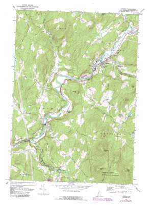
Lisbon Topo Map New Hampshire
To zoom in, hover over the map of Lisbon
USGS Topo Quad 44071b8 - 1:24,000 scale
| Topo Map Name: | Lisbon |
| USGS Topo Quad ID: | 44071b8 |
| Print Size: | ca. 21 1/4" wide x 27" high |
| Southeast Coordinates: | 44.125° N latitude / 71.875° W longitude |
| Map Center Coordinates: | 44.1875° N latitude / 71.9375° W longitude |
| U.S. State: | NH |
| Filename: | o44071b8.jpg |
| Download Map JPG Image: | Lisbon topo map 1:24,000 scale |
| Map Type: | Topographic |
| Topo Series: | 7.5´ |
| Map Scale: | 1:24,000 |
| Source of Map Images: | United States Geological Survey (USGS) |
| Alternate Map Versions: |
Lisbon NH 1967, updated 1972 Download PDF Buy paper map Lisbon NH 1967, updated 1977 Download PDF Buy paper map Lisbon NH 1967, updated 1977 Download PDF Buy paper map Lisbon NH 1967, updated 1988 Download PDF Buy paper map Lisbon NH 1967, updated 1988 Download PDF Buy paper map Lisbon NH 1995, updated 2000 Download PDF Buy paper map Lisbon NH 2012 Download PDF Buy paper map Lisbon NH 2015 Download PDF Buy paper map |
| FStopo: | US Forest Service topo Lisbon is available: Download FStopo PDF Download FStopo TIF |
1:24,000 Topo Quads surrounding Lisbon
> Back to 44071a1 at 1:100,000 scale
> Back to 44070a1 at 1:250,000 scale
> Back to U.S. Topo Maps home
Lisbon topo map: Gazetteer
Lisbon: Bends
Salmon Hole elevation 180m 590′Lisbon: Bridges
Bath Bridge elevation 146m 479′Salmon Hole Bridge elevation 181m 593′
Swiftwater Bridge elevation 203m 666′
Lisbon: Dams
Ammonoosuc River Dam elevation 221m 725′Lower Lisbon Dam elevation 179m 587′
Lisbon: Flats
Cole Plain elevation 230m 754′The Plain elevation 216m 708′
Lisbon: Lakes
Gordon Pond elevation 331m 1085′Hanno Pond elevation 175m 574′
Lisbon: Populated Places
Bath elevation 158m 518′Ireland elevation 372m 1220′
Jockey Hill elevation 318m 1043′
Landaff Center elevation 348m 1141′
Lisbon elevation 180m 590′
Nutter elevation 272m 892′
Pettyboro elevation 200m 656′
Savageville elevation 227m 744′
Swiftwater elevation 210m 688′
Upper Village elevation 158m 518′
West Bath elevation 221m 725′
Lisbon: Reservoirs
Ammonoosuc River Reservoir elevation 221m 725′Ammonoosuc River Reservoir elevation 179m 587′
Lower Mountain Lake elevation 238m 780′
Lisbon: Streams
Childs Brook elevation 144m 472′Cole Brook elevation 200m 656′
Mill Brook elevation 164m 538′
Moulton Hill Brook elevation 234m 767′
Ogontz Brook elevation 180m 590′
Pearl Lake Brook elevation 173m 567′
Pettyboro Brook elevation 158m 518′
Salmon Hole Brook elevation 181m 593′
Simonds Brook elevation 146m 479′
Teter Meadow Brook elevation 233m 764′
Waterman Brook elevation 187m 613′
Wild Ammonoosuc River elevation 145m 475′
Lisbon: Summits
Babbit Hill elevation 331m 1085′Foster Hill elevation 568m 1863′
Green Mountain elevation 667m 2188′
Moody Ledge elevation 708m 2322′
Moulton Hill elevation 379m 1243′
Mount Hope elevation 508m 1666′
Trevena Hill elevation 407m 1335′
Young Mountain elevation 611m 2004′
Lisbon: Valleys
Black Valley elevation 164m 538′Dark Hollow elevation 212m 695′
Sunny Valley elevation 182m 597′
Lisbon digital topo map on disk
Buy this Lisbon topo map showing relief, roads, GPS coordinates and other geographical features, as a high-resolution digital map file on DVD:
Maine, New Hampshire, Rhode Island & Eastern Massachusetts
Buy digital topo maps: Maine, New Hampshire, Rhode Island & Eastern Massachusetts


