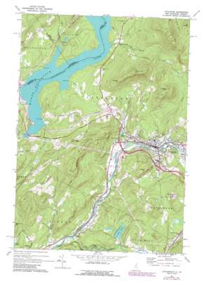
Littleton Topo Map New Hampshire
To zoom in, hover over the map of Littleton
USGS Topo Quad 44071c7 - 1:24,000 scale
| Topo Map Name: | Littleton |
| USGS Topo Quad ID: | 44071c7 |
| Print Size: | ca. 21 1/4" wide x 27" high |
| Southeast Coordinates: | 44.25° N latitude / 71.75° W longitude |
| Map Center Coordinates: | 44.3125° N latitude / 71.8125° W longitude |
| U.S. States: | NH, VT |
| Filename: | o44071c7.jpg |
| Download Map JPG Image: | Littleton topo map 1:24,000 scale |
| Map Type: | Topographic |
| Topo Series: | 7.5´ |
| Map Scale: | 1:24,000 |
| Source of Map Images: | United States Geological Survey (USGS) |
| Alternate Map Versions: |
Littleton NH 1971, updated 1973 Download PDF Buy paper map Littleton NH 1971, updated 1988 Download PDF Buy paper map Littleton NH 1971, updated 1988 Download PDF Buy paper map Littleton NH 2012 Download PDF Buy paper map Littleton NH 2015 Download PDF Buy paper map |
1:24,000 Topo Quads surrounding Littleton
> Back to 44071a1 at 1:100,000 scale
> Back to 44070a1 at 1:250,000 scale
> Back to U.S. Topo Maps home
Littleton topo map: Gazetteer
Littleton: Benches
Slate Ledge elevation 393m 1289′Littleton: Crossings
Interchange 39 elevation 335m 1099′Interchange 41 elevation 287m 941′
Interchange 42 elevation 231m 757′
Interchange 43 elevation 292m 958′
Littleton: Dams
Ice Pond Dam elevation 237m 777′Streeter Pond Dam elevation 281m 921′
Littleton: Lakes
Dells Pond elevation 242m 793′Perch Pond elevation 221m 725′
Littleton: Parks
Remich Park elevation 275m 902′The Dells elevation 235m 770′
Littleton: Populated Places
Barrett elevation 205m 672′Coreys Mobile Park elevation 258m 846′
Gilman Mobile Park elevation 262m 859′
Hilltop Manor Extension Mobile Home Park elevation 270m 885′
Littleton elevation 251m 823′
North Littleton elevation 278m 912′
Toneys Mobile Park elevation 262m 859′
Littleton: Post Offices
Littleton Post Office elevation 249m 816′Littleton: Reservoirs
Ice Pond elevation 237m 777′Mount Eustis Reservoir elevation 366m 1200′
Oak Hill Reservoir elevation 326m 1069′
Streeter Pond elevation 281m 921′
Littleton: Ridges
Walker Mountain elevation 543m 1781′Littleton: Streams
Baker Brook elevation 251m 823′Cow Brook elevation 246m 807′
Gale River elevation 200m 656′
Halls Brook elevation 246m 807′
Mullikin Brook elevation 249m 816′
Palmer Brook elevation 248m 813′
Littleton: Summits
Eustis Hill elevation 415m 1361′Farr Hill elevation 597m 1958′
Mount Misery elevation 589m 1932′
Parker Mountain elevation 579m 1899′
Pine Hill elevation 342m 1122′
Towns Mountain elevation 671m 2201′
Wheeler Hill elevation 475m 1558′
Littleton digital topo map on disk
Buy this Littleton topo map showing relief, roads, GPS coordinates and other geographical features, as a high-resolution digital map file on DVD:
Maine, New Hampshire, Rhode Island & Eastern Massachusetts
Buy digital topo maps: Maine, New Hampshire, Rhode Island & Eastern Massachusetts


