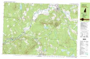
Lancaster Topo Map New Hampshire
To zoom in, hover over the map of Lancaster
USGS Topo Quad 44071d5 - 1:25,000 scale
| Topo Map Name: | Lancaster |
| USGS Topo Quad ID: | 44071d5 |
| Print Size: | ca. 39" wide x 24" high |
| Southeast Coordinates: | 44.375° N latitude / 71.5° W longitude |
| Map Center Coordinates: | 44.4375° N latitude / 71.625° W longitude |
| U.S. States: | NH, VT |
| Filename: | k44071d5.jpg |
| Download Map JPG Image: | Lancaster topo map 1:25,000 scale |
| Map Type: | Topographic |
| Topo Series: | 7.5´x15´ |
| Map Scale: | 1:25,000 |
| Source of Map Images: | United States Geological Survey (USGS) |
| Alternate Map Versions: |
Lancaster NH 1982, updated 1983 Download PDF Buy paper map Lancaster NH 1982, updated 1983 Download PDF Buy paper map |
1:24,000 Topo Quads surrounding Lancaster
> Back to 44071a1 at 1:100,000 scale
> Back to 44070a1 at 1:250,000 scale
> Back to U.S. Topo Maps home
Lancaster topo map: Gazetteer
Lancaster: Bridges
Mechanic Street Bridge elevation 266m 872′Mount Orne Bridge elevation 256m 839′
Mount Orne Covered Bridge elevation 252m 826′
Lancaster: Dams
Gilman Project Dam elevation 252m 826′Gold Mine Pond Dam elevation 306m 1003′
Lancaster: Lakes
Blood Pond elevation 321m 1053′Cherry Pond elevation 338m 1108′
Clark Pond elevation 303m 994′
Little Cherry Pond elevation 332m 1089′
Martin Meadow Pond elevation 326m 1069′
Mirror Lake elevation 316m 1036′
Mud Pond elevation 345m 1131′
Neal Pond elevation 366m 1200′
Weed Pond elevation 333m 1092′
Weeks Pond elevation 338m 1108′
Lancaster: Parks
John Wingate Weeks Historic Site elevation 612m 2007′Pondicherry Wildlife Refuge elevation 334m 1095′
Lancaster: Populated Places
Baileys elevation 336m 1102′Baptist Hill elevation 458m 1502′
Cushman elevation 299m 980′
Dalton elevation 276m 905′
Gilman elevation 262m 859′
Grange elevation 294m 964′
Lancaster elevation 263m 862′
Lunenburg elevation 357m 1171′
Mill Village elevation 376m 1233′
Riverton elevation 319m 1046′
Scott elevation 262m 859′
South Lancaster elevation 260m 853′
South Lunenburg elevation 262m 859′
Lancaster: Reservoirs
Gilman Project Reservoir elevation 252m 826′Gold Mine Pond elevation 306m 1003′
Lancaster: Ridges
Elm Ridge elevation 366m 1200′Lancaster: Streams
Burnside Brook elevation 297m 974′Caleb Brook elevation 297m 974′
Catbow Brook elevation 252m 826′
Chase Brook elevation 268m 879′
Cushman Brook elevation 242m 793′
Garland Brook elevation 314m 1030′
Hudson Brook elevation 258m 846′
Israel River elevation 256m 839′
Johns River elevation 254m 833′
Mink Brook elevation 252m 826′
Neal Brook elevation 258m 846′
Otter Brook elevation 282m 925′
Scales Brook elevation 261m 856′
Stalbird Brook elevation 306m 1003′
Turner Brook elevation 258m 846′
Lancaster: Summits
Baldwin Hill elevation 577m 1893′Baptist Hill elevation 463m 1519′
Beede Mountain elevation 557m 1827′
Blue Hill elevation 502m 1646′
Bray Hill elevation 488m 1601′
Bunker Hill elevation 337m 1105′
Dalton Mountain elevation 648m 2125′
Mount Pleasant elevation 561m 1840′
Orne Mountain elevation 560m 1837′
Prospect Mountain elevation 621m 2037′
Tug Mountain elevation 450m 1476′
Wallace Hill elevation 577m 1893′
Lancaster digital topo map on disk
Buy this Lancaster topo map showing relief, roads, GPS coordinates and other geographical features, as a high-resolution digital map file on DVD:
Maine, New Hampshire, Rhode Island & Eastern Massachusetts
Buy digital topo maps: Maine, New Hampshire, Rhode Island & Eastern Massachusetts


