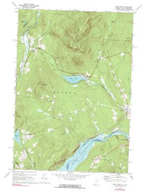
Miles Pond Topo Map Vermont
To zoom in, hover over the map of Miles Pond
USGS Topo Quad 44071d7 - 1:24,000 scale
| Topo Map Name: | Miles Pond |
| USGS Topo Quad ID: | 44071d7 |
| Print Size: | ca. 21 1/4" wide x 27" high |
| Southeast Coordinates: | 44.375° N latitude / 71.75° W longitude |
| Map Center Coordinates: | 44.4375° N latitude / 71.8125° W longitude |
| U.S. States: | VT, NH |
| Filename: | o44071d7.jpg |
| Download Map JPG Image: | Miles Pond topo map 1:24,000 scale |
| Map Type: | Topographic |
| Topo Series: | 7.5´ |
| Map Scale: | 1:24,000 |
| Source of Map Images: | United States Geological Survey (USGS) |
| Alternate Map Versions: |
Miles Pond VT 1967, updated 1972 Download PDF Buy paper map Miles Pond VT 1967, updated 1991 Download PDF Buy paper map Miles Pond VT 1968, updated 1983 Download PDF Buy paper map Miles Pond VT 2012 Download PDF Buy paper map Miles Pond VT 2015 Download PDF Buy paper map |
1:24,000 Topo Quads surrounding Miles Pond
> Back to 44071a1 at 1:100,000 scale
> Back to 44070a1 at 1:250,000 scale
> Back to U.S. Topo Maps home
Miles Pond topo map: Gazetteer
Miles Pond: Dams
Miles Pond Dam elevation 313m 1026′Miles Pond: Lakes
Johnson Pond elevation 336m 1102′Shadow Lake elevation 407m 1335′
Miles Pond: Parks
Samuel Reed Hall Monument elevation 468m 1535′Miles Pond: Populated Places
Concord Corner elevation 465m 1525′East Concord elevation 266m 872′
Miles Pond elevation 313m 1026′
North Concord elevation 328m 1076′
Ralston Corner elevation 421m 1381′
Texas elevation 329m 1079′
Miles Pond: Reservoirs
Miles Pond elevation 313m 1026′Miles Pond: Streams
Carpenter Brook elevation 256m 839′Carr Brook elevation 281m 921′
Cutting Brook elevation 284m 931′
Dudley Brook elevation 294m 964′
Miles Stream elevation 250m 820′
Mink Brook elevation 254m 833′
Roaring Brook elevation 273m 895′
Miles Pond: Summits
Goudreault Hill elevation 619m 2030′King Hill elevation 563m 1847′
Miles Mountain elevation 813m 2667′
Shaw Mountain elevation 552m 1811′
Miles Pond: Swamps
Hastings Swamp elevation 397m 1302′Miles Pond digital topo map on disk
Buy this Miles Pond topo map showing relief, roads, GPS coordinates and other geographical features, as a high-resolution digital map file on DVD:
Maine, New Hampshire, Rhode Island & Eastern Massachusetts
Buy digital topo maps: Maine, New Hampshire, Rhode Island & Eastern Massachusetts


